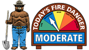
TIF Dispatch Area Preparedness and Staffing

Updated:
FDRA ERC BI FDR Forecast BI Forecast ERC Staffing Class Tomorrow's Response Level
Teton 18.75/54.50 percentile 15.51/55.70 percentile Low 15.19/55.20 percentile 21.5/57.50 percentile 1 Low
Bridger 18.19/55.00 percentile 10.34/53.00percentile Low 9.65/52.40 percentile 19.07/55.80 percentile 1 Low

(Jackson, WY, Sept. 17, 2026) — The North Zone of the Bridger-Teton National Forest, which includes Jackson and Blackrock Ranger Districts, are planning prescribed fires as early as Sept. 23. Forest Service officials estimate this work may continue through Dec. 31, as conditions allow. Certified prescribed fire specialists use prescribed fires to help reduce wildfire risk, improve habitat, and restore fire-adapted ecosystems.

Type of Work:

Pile Burning is planned for the following areas:

  • North Zone Programmatic Pile Burning (approximately 100 acres of burn piles dispersed across small sites around the Jackson and Blackrock Ranger Districts including Shadow Mountain, Pritchard Pass, Hoback Campground, Taylor Mountain, Darwin Ranch, Flagstaff Road, Pacific Creek, as well as various Jackson and Blackrock administrative sites)

Broadcast burning is planned for the following areas:

  • Teton to Snake Rx Project (Taylor Mountain Rx Unit, six miles southwest of Jackson, WY, off Fall Creek Road, near Bronco Road)

  • Upper Gros Ventre Rx Project (25 miles northeast of Jackson, WY, in the area of Slate Creek and Haystack Fork)

Closures or Safety Notes:
No closures are currently planned for prescribed fire activity. However, visitors should remain alert in the areas as firefighters work. Watch for warning signs along roads near all prescribed fire areas before and during burns to avoid hazards.

Smoke Information:
While smoke may be visible, the Forest Service works closely with air quality specialists and closely monitors smoke during prescribed fires. Prescribed fires are timed for best smoke management. Visit AirNow.gov for current air quality information. When driving, slow down and turn on your headlights when you encounter smoke on the road. Please do not report these fires, as firefighters will remain on scene throughout ignitions and patrol afterwards.

Additional Notifications:
The Forest Service will evaluate conditions in the days and hours before ignition. County emergency management will be notified prior to ignitions. If conditions are not favorable, planned prescribed fire activities may be postponed or canceled.

Stay Informed:
For current updates about the prescribed fire schedule, visit:

Additional local or partner channels: TetonFires.com

Bridger-Teton National Forest North Zone Plans Prescribed Burning

(Afton, WY, Sept. 23, 2026) — The West Zone of the Bridger-Teton National Forest, which includes Greys River and Kemmerer Ranger Districts, is planning prescribed fires as early as Oct. 1. Forest Service officials estimate this work may continue through Dec. 31, as conditions allow. Certified prescribed fire specialists use prescribed fires to help reduce hazardous fuels and wildfire risk, improve habitat, and restore fire-adapted ecosystems.

Type of Work:

Broadcast burning is planned for the following areas:

  • Star Valley Front Rx Project, Units 8 and 9 (Unit 8 is approximately three miles east of Turnerville, WY. The northern boundary is the North Fork Willow Creek Drainage, the eastern boundary is the ridgeline between McDougal Pass and Mt. Fitzpatrick, the southern boundary is Swift Creek, and the western boundary is Willow Creek. Unit 9 is five miles east of Bedford, WY, approximately three miles up the Strawberry Creek Trail.

  • LaBarge Rx Project, Units 8, 9, 10, 17, and 29 (Approximately 18 miles southeast of Smoot, WY, Unit 29 Tri Basin Divide, and Units 8, 9, 10, and 17 are approximately 11 miles up LaBarge Creek Road, between Clear Creek and Crystal Creek)

Pile Burning is planned for the following areas:

  • West Zone Programmatic Pile Burning (489 acres of burn piles along HWY 89 from Salt Pass to the Forest boundary, 5 acres of piles on the Hams Fork Road at the Forest boundary, 5 acres of piles on the Greys River Road in Alpine, WY, various timber slash piles on the Kemmerer Ranger District, and various administrative piles on the Greys River and Kemmerer Ranger Districts) 

Closures or Safety Notes:
No closures are currently planned for prescribed fire activity. However, visitors should remain alert in the areas as firefighters work. Watch for warning signs along roads near all prescribed fire areas before and during burns to avoid hazards.

Smoke Information:
While smoke may be visible, the Forest Service works closely with air quality specialists and closely monitors smoke during prescribed fires. Prescribed fires are timed for best smoke management. Visit AirNow.gov for current air quality information. When driving, slow down and turn on your headlights when you encounter smoke on the road. Please do not report these fires, as firefighters will remain on scene throughout ignitions and patrol afterwards.

Additional Notifications:
The Forest Service will evaluate conditions in the days and hours before ignitions. County emergency management will be notified prior to ignitions. If conditions are not favorable, planned prescribed fire activities may be postponed or canceled.

Stay Informed:
For current updates about the prescribed fire schedule, visit:


Bridger-Teton National Forest West Zone Plans Prescribed Burning

Wildland and Prescribed Fire Map

Star Valley Front Prescribed Fire

42.891, -110.822
Prescribed Fire

Taylor Mountain

43.367, -110.774
Prescribed Fire

La Barge Vegetation Restoration Project

42.524903, -110.687967
Prescribed Fire

Gros Ventre RX

43.633375, -110.383463
Prescribed Fire