Weather
Fire weather forecasts, observations, and tools for Central Oregon.
COIDC Products
- Central Oregon Fire Danger Weekly Outlook — seasonal PDF posted during fire season.
Recent Fire Risk
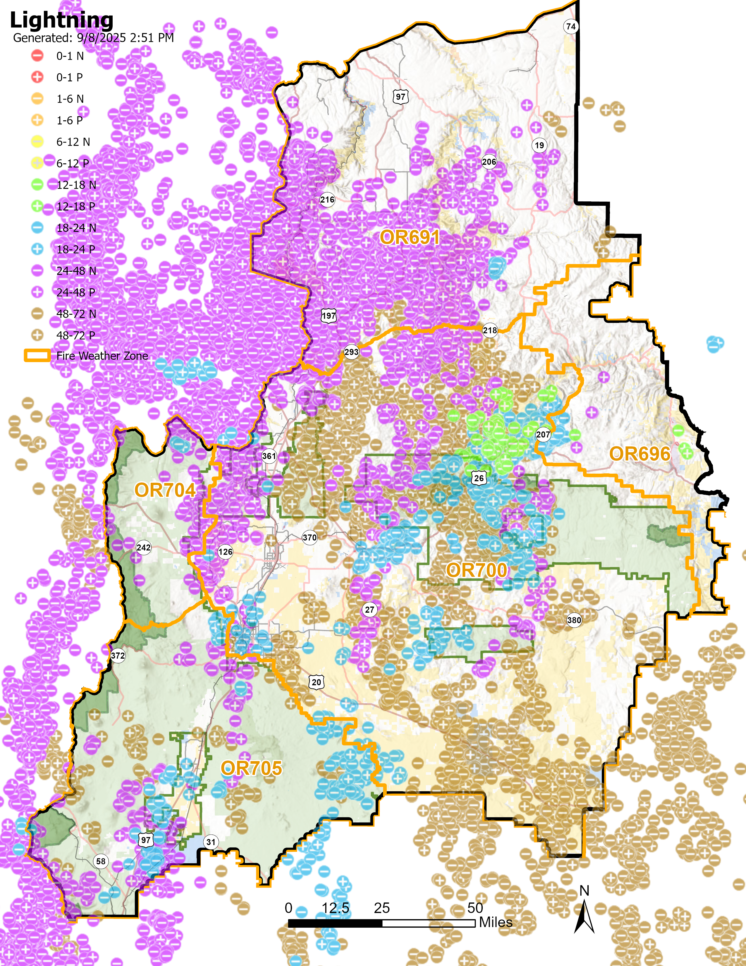
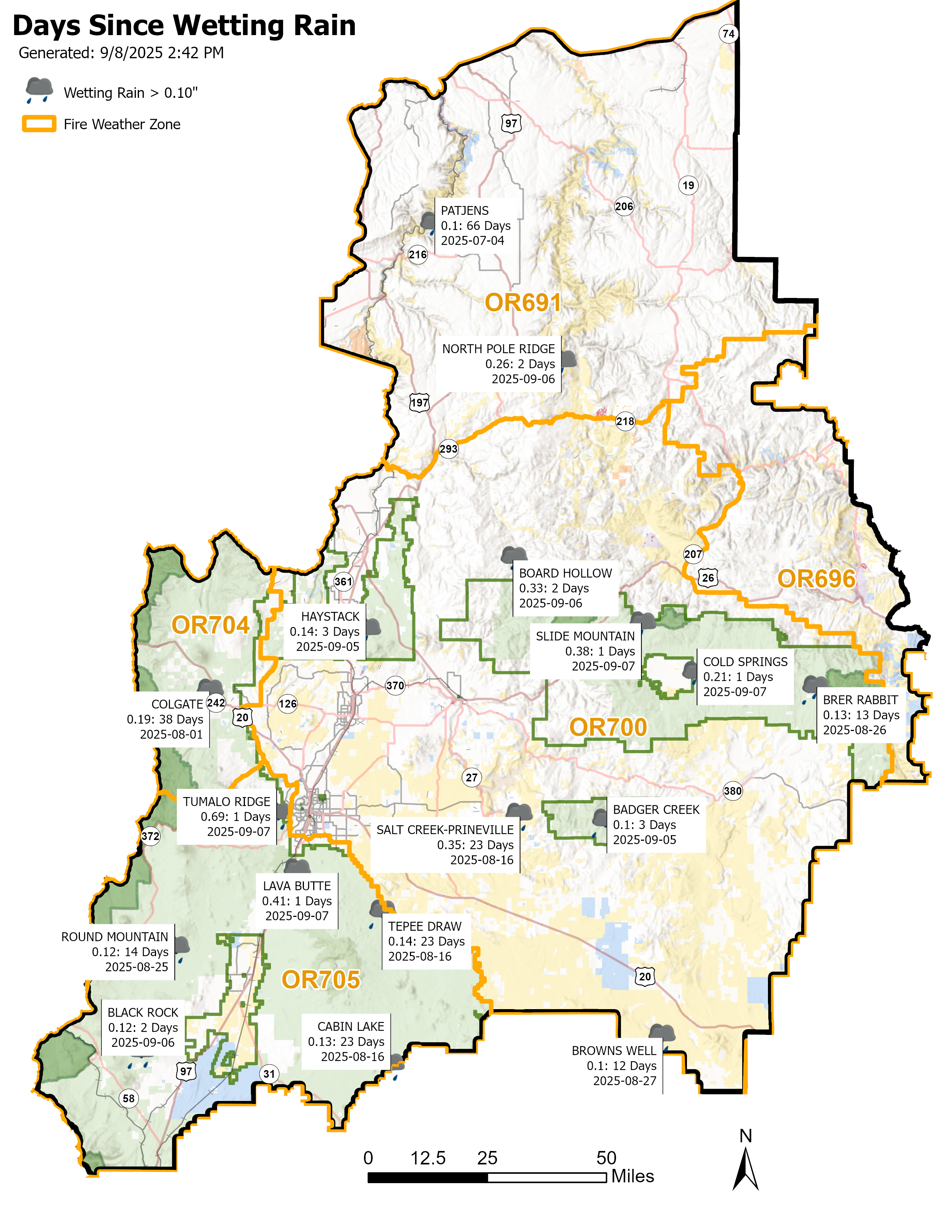
72-hour lightning activity and recent wetting rain across the COIDC RAWS network.
Fire Weather Matrices
Daily forecast by representative point, from NWS gridpoint data (the same gridded source as the NWS fire-weather point forecast). What the colors mean
Loading fire weather matrices…
Fire Weather Forecast
NWS Pendleton 7-day graphics plus Hot-Dry-Windy, pulled live from NWS and the Forest Service. All seven days show at once for the trend; switch to Single day to focus. Click any image for full size.
More: NWS Fire Weather Planning Forecast (PDT). Hot-Dry-Windy is the GEFS 90th-percentile probability.
Fire Weather Matrix — color thresholds
Daily values from the NWS gridpoint forecast. Temp, RH, Wind, and Gust use fire-weather thresholds (green calm to red critical). Precip and sky are tinted by amount. Ventilation Index shows as a category.
Max Temp °F
<70 70–79 80–89 90–99 100+
Min RH %
≥40 30–39 20–29 15–19 <15
Wind mph
<10 10–19 20–24 25–34 35+
Gust mph
<15 15–27 28–34 35–44 45+
Chance of Precip % · QPF in
Tinted by amount, wetter is favorable. Precip: ≥10 ≥30 ≥60. QPF: ≥0.01 ≥0.10 ≥0.25 in.
Sky %
25–49 50–74 75+ cloud cover.
Ventilation Index = transport wind (kts) × mixing height (ft) ÷ 100
Low <200 Moderate 200–499 (good Rx-burn window) High 500–699 Very High 700+ (large fire-growth potential)