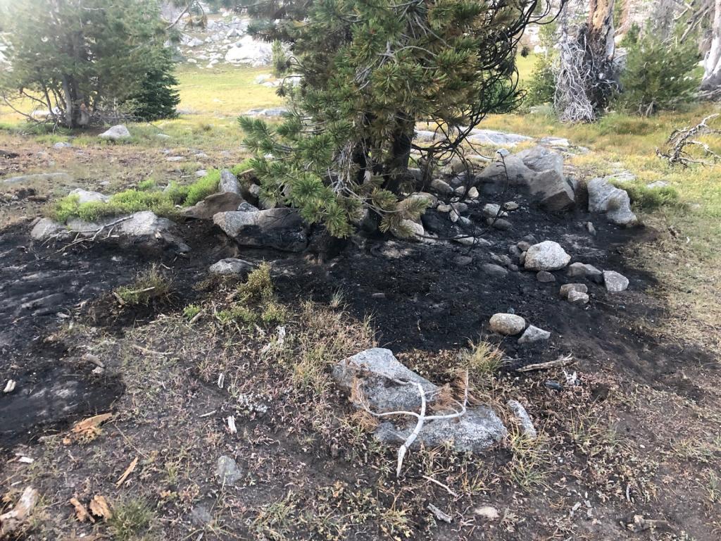
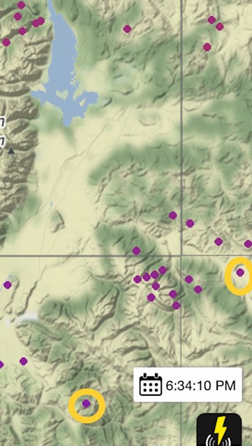
Resources are engaged on the Dollar Lake Fire on the Upper Green Rd. Closure Order in effect.  

Resources are engaged on the Willow Creek Fire southwest of Smoot. Closure Order in effect. 


Ski Lake

This small fire was detected late in the evening as a tree torched along the ridge line and making the flames visible to homeowners living in along the Snake River in Teton County. Teton interagency helicopter flew the fire and found a small 1/4 acre fire burning within a stand of heavy mixed timber. Two West Yellowstone Smokejumpers are suppressing the fire and will hike off the fire after is has been contained and controlled. The fire is a lightning start from the storm passing over the area later this last week.

Beaver Trail

This lightning caused fire is burning approximately one mile north of the Beaver trailhead. Fire behavior is smoldering in grass and sage in an isolated stand of timber. Firefighters from the Big Piney and Pinedale Ranger Districts have hiked in to the fire and are taking suppression action at this time.

White Rock

Google map image showing the fire location adjacent to the Upper Green River Lake.Five firefighters from the Pinedale and Big Piney Ranger Districts have hiked in fire and will be fully suppressing the fire using Minimum Impact Suppression Tactics (MIST)

Wilson Canyon

Afternoon winds on August 25th woke the sleepy Wilson Canyon Fire after what appears to be a long period of smoldering fire behavior at the base of a large Douglas fir. The 4.7 acre fire was called into fire dispatch through forest visitors recreating in the canyon area. Local interagency firefighters from Jackson Hole Fire/EMS helped to support suppression efforts along with water bucket operations from Helicopter 35HX. The fire was called out -


Tepee

Lightning maps and fire cause of determination provided enough evidence for initial attack firefighters to establish the Tepee fire igniting on the morning of August 22nd after a lightning storm tracked over the Gros Ventre area of the Jackson District. Located 1 mile south and west of the main Gros Ventre road, the fire is under a full suppression strategy. The remaining two firefighters will hike off the fire on the afternoon of 25th, once the fire is in controlled status.

Porcupine

This fire was discovered by hikers and reported burning in the Bridger Wilderness alongside a trail. Firefighters hiked in and were able to suppress the fire by the following day. UPDATE: The cause is suspected to be from burning toilet paper (see photos). The area had not received recent lightning. 

Fire Trail

This fire is located 4 miles south of Alpine and approximately 1 mile west in the Squaw Creek drainage and is human caused. The fire is approximately 30 acres in size due to more accurate GPS mapping of the burned area. The Squaw-Murphy route (Forest Road #10001-Forest Trail #3183) closure has been rescinded and is now open for recreation. The Fire Trail Fire was declared out late afternoon on August 30, 2018. 

Hams Fork

The Hams Fork Fire, 1 mile west (not 3-miles west as news release states) of the Hams Fork Campground, started by lightning on Thursday and was reported late Friday afternoon. The 3-acre fire was burning in mixed conifer, heavy dead and down timber.  

Sandy

This lighting caused fire was reported by the Big Sandy lodge. It's located approximately a half mile north of the lodge. Three Sublette County engines responded along with the Big Piney Ranger District Engine 421. E-421 stayed the night and are continuing suppression efforts.

Sage

Lightning activity over the area on the evening of August 1st is responsible for the start of the Sage Fire burning in a single tree. Teton Interagency Fire Engine 441 responded to suppress the small fire and will be using the incident as a training platform for one of the engine crew members to support incident commander qualifications for future initial attack efforts.