
Porcupine Fire
This is a new fire start from the lightning storm passing over the Teton area on 8/28, detected on Saturday by a homeowner living in the Munger Mountain area. This small fire .10 acre is smoldering in heavy timber and has moderate potential for growth. Due to the proximity of the fire and the wildland urban interface, this fire is being fully suppressed.
During these dry conditions the public's help in detecting fires is very helpful!
Thank you to the two individuals who took the time to call Teton Interagency Fire Dispatch with the reported smokes from this last storm. When calling in a smoke report fire dispatchers will ask you for the location or description of the area of the fire you are reporting, what does the smoke look like, is it a puff, a layer or a column of smoke. You will be asked your guesstimate of the size of the fire, are there flames visible and your location from where you see the smoke/fire.
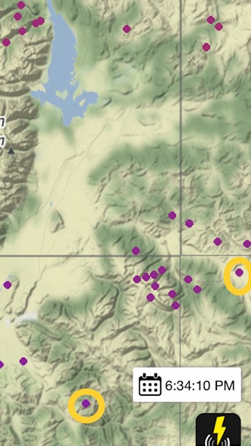
It’s your help with these early detections that help fire managers make the soundest decision and prudent response for public and firefighter safety as the priority objective. The lightning map above is one of the many tools used in fire detection and help patrollers with areas to look for new fire starts. The lightning map helps to confirm both the Gray Hills and Porcupine natural fire starts.
43.396944, -110.666389
Porcupine Canyon