
Mc Michael
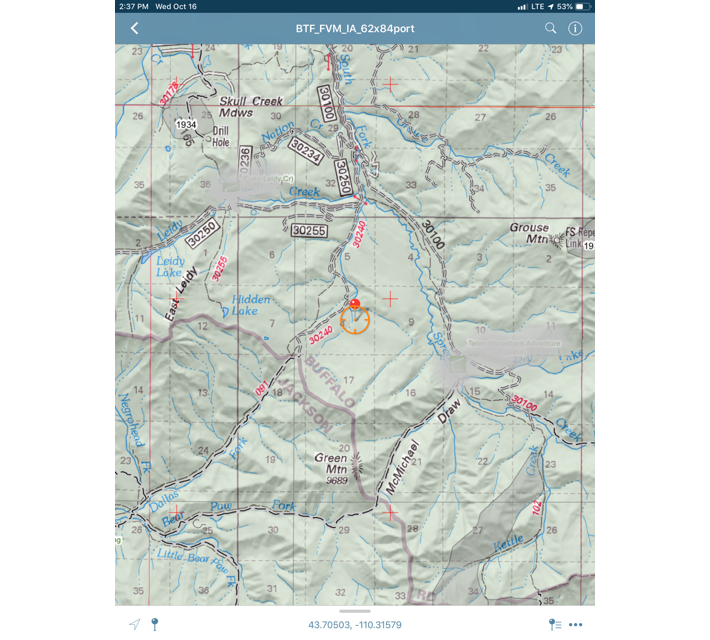
This fire is currently under investigation. Local outfitter and hunting guides called the smoke report and location into Teton Interagency Fire Dispatch on 10/16. Soon after, Teton Interagency Fire Module responded to the area and located the 1/2 acre fire torching near the Green Mountain and McMichael Draw areas close to the South Fork of Spread Creek. The fire appears to have been smoldering for several days before detection and any information on the fire's cause can be shared to 307-739-5424
This photo was taken north of the McMichael Fire, looking towards the burning timbered island where the fire started. The photo is taken from the old 30420 FS Road, looking south, before crossing down slope, and into the small drainage. Many hunters have been in the area over the last few weeks and we ask everyone visiting public lands, to please apply best practices for resource protection and be a steward of the land. to learn about the proper technique to make sure your fire is dead out, click the following link recorded by Randy Newburg,
Warming fires, if it's too hot to touch, it is too hot to leave!
