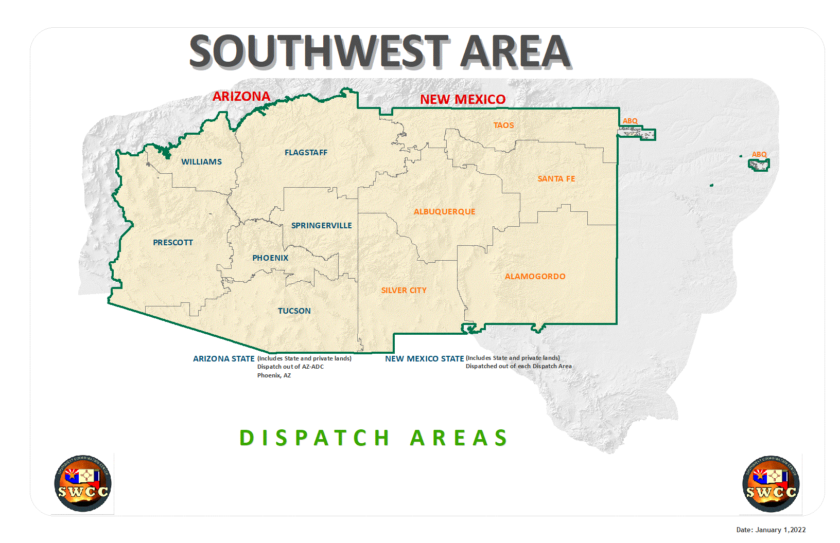
The Southwest Coordination Center (SWCC) is the interagency focal point for coordinating the mobilization of resources between the twelve Federal and State Dispatch Centers of the Southwest Area and, when necessary, the National Coordination Center (NICC) in Boise, ID.
Located in Albuquerque, New Mexico, the SWCC provides logistical support (i.e. mobilization / demobilization) for wildland fire, prescribed fire, and other all-risk incidents. In addition, the Center provides Predictive Services and Intelligence related-products in support of incident management decision-making for wildland fire managers and on-the-ground wildland firefighters.
To learn more, go to "About Us" ...

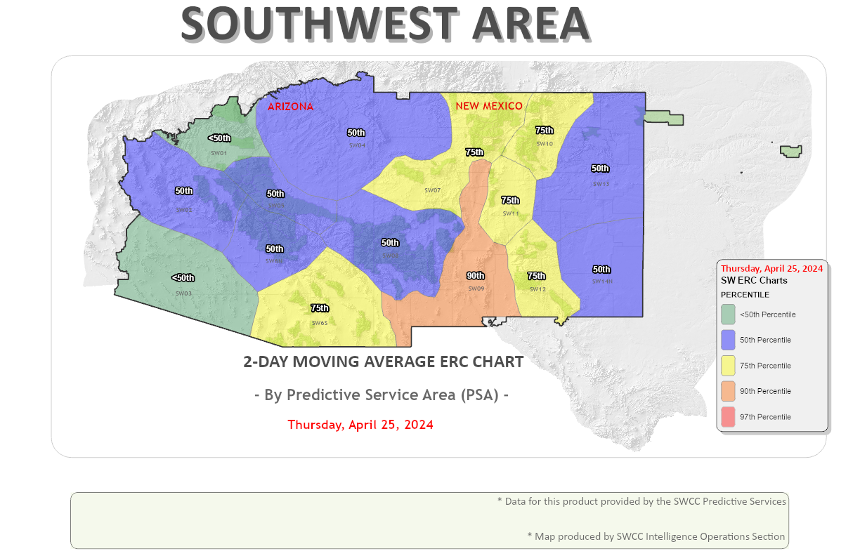
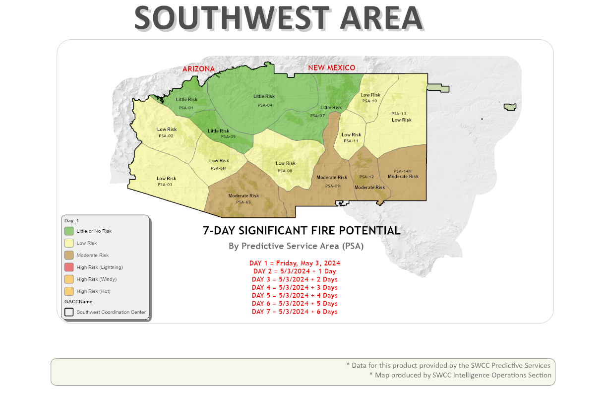
SWCC Intelligence Dashboard