

![[Graphic] - About Us](../images/U1_Admin_About_Us.gif)
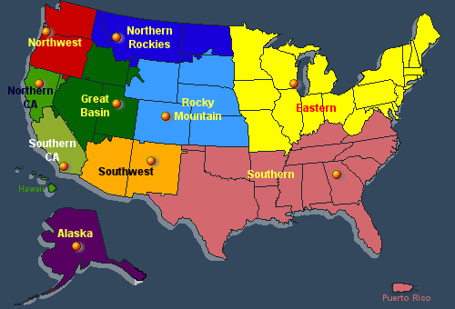
Under the umbrella of the National Interagency Fire Center and the National Wildfire Coordinating Group (NWCG), there are ten Geographic Areas across the U.S. Each Geographic Area is established to manage collaboratively wildland fire and other incident management activities.
The Southwest Area (SWA) is one of ten Geographic Areas across the United States and Alaska. Established in the 1970's, the geographic boundaries for the SWA primarily consists of those lands within the States of Arizona and New Mexico. Along with the States of Arizona's Deparment of Forestry and Fire Management and the State of New Mexico's Energy, Minerals, and Natural Resources Department (Forestry Division), the SWA also consists of U. S. Federal land management agencies including the Bureau of Indidan Affairs, Bureau of Land Managent, National Park Service, U.S. Fish & Wildlife Service, and the U. S. Forest Service.
The Southwest Coordinating Group (SWCG) consists of Regional Fire Directors and Managers from each of the primary cooperating Federal (USDOI - BIA, BLM, FWS, NPS; USDA - USFS) and State Agencies (Arizona and New Mexico) within the Southwest Area. This group has overall responsibility for allocating and prioritizing resources during times of multiple incidents, overseeing the mobilization of emergency resources as a whole, developing and managing Incident Management Teams (IMT), and coordinating information and intelligence within the Southwest Area.
When the SWA Preparedness Level rises to the Level of 4 or above, the SWCG will convene as the Geographic Area Mutli-agency Coordinating Group (GMAC). In this role, the GMAC will prioritize incidents for the purpose of allocating critical wildland fire resources.
The Southwest Coordination Center (SWCC) is an interagency office consisting of personnel from USDI Bureau of Indian Affairs, USDI Bureau of Land Management, USDI National Park Service, USDI Fish & Wildlife Service, and USDA Forest Service. The purpose of the Center is to be the focal point for logistical support (i.e. mobilization and demobilization of resources) between the twelve Dispatch Centers within the Southwest Area, and the National Coordination Center. In addition, the Center provides decision support products produced by the SW Predictive Services and SW Intelligence Operations Section.
Southwest Area / Agencies and Units
Primary cooperating Federal and State Agencies in the Southwest Area include the USDA Forest Service, USDI Bureau of Land Management, USDI National Park Service, USDI Bureau of Indian Affairs, USDI Fish and Wildlife Service, State of Arizona (Arizona State Forestry), and the State of New Mexico (New Mexico State Forestry). Under these Land Management agencies, there are over 100 identified land management units covering millions of acres.
Southwest Area / Zone / Dispatch Center Concept
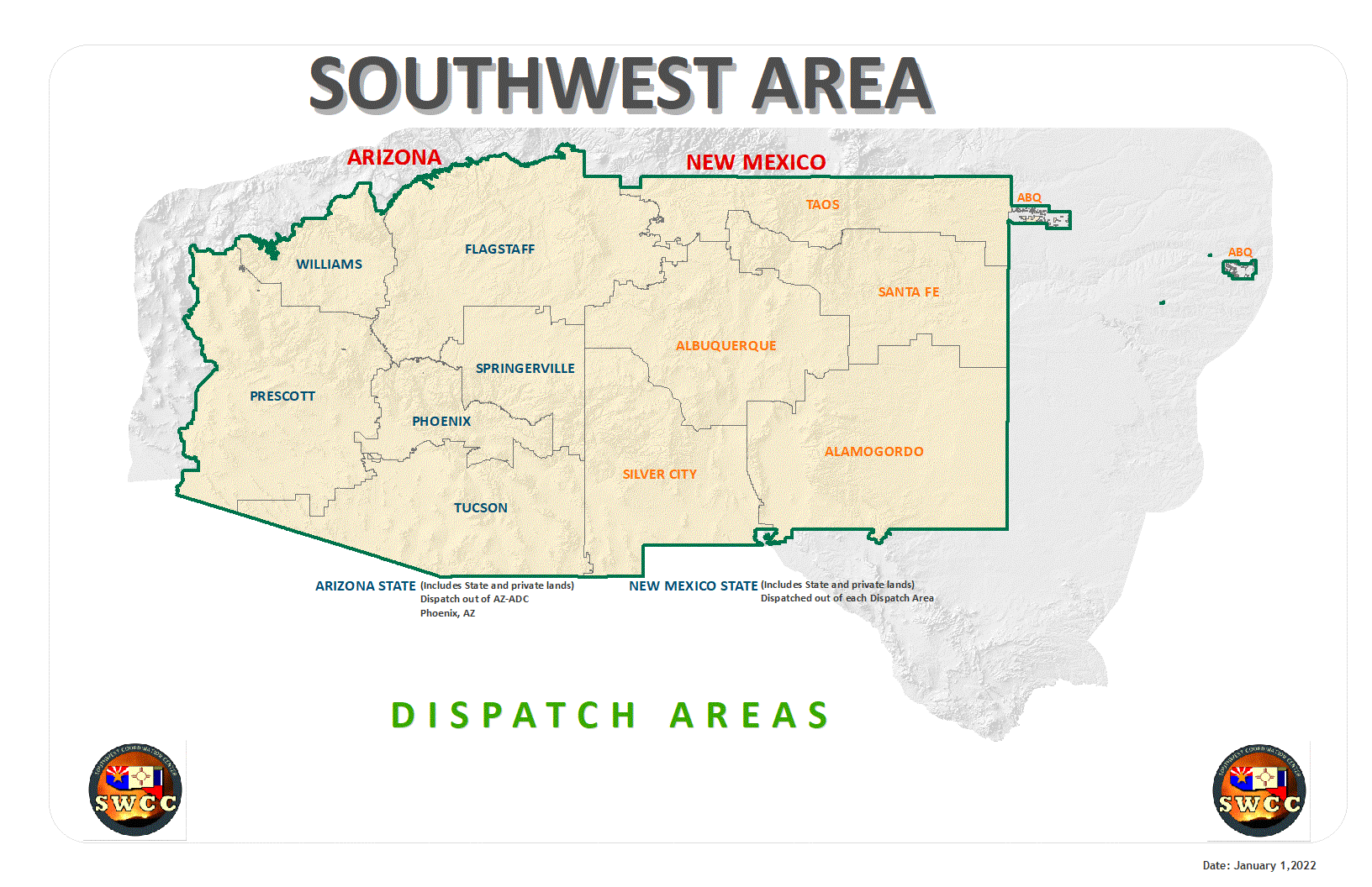
The Southwest Area is divided into nine Zones. Within each Zone, an interagency Zone Coordinating Group is promulgated and comprised of representatives from the Federal and State agencies within the Zone. In addition, an interagency dispatch center is established to provide logistical support and intelligence related products to the units within the Zone.
Southwest Area / Agency and Unit Location Maps