
NATIONAL FIRE DANGER RATING SYSTEM (NFDRS)
- Energy Release Component (ERC) Charts -
- By Selected Individual Stations -
![[Graphic] - SWA Weather Station ERC & BI Location Map](../images/Map_Individual_Stations.png)
Click on Station Number to view.
** Charts are created using Fuel Model G (Short Needle / Heavy Dead) as the representative model and posted Tuesday and Friday March 1 - October 31, and Friday's only November 1 - February 28/29.
| STATION NUMBER | STATION NAME | AGENCY | ASSOCIATED UNIT |
|---|---|---|---|
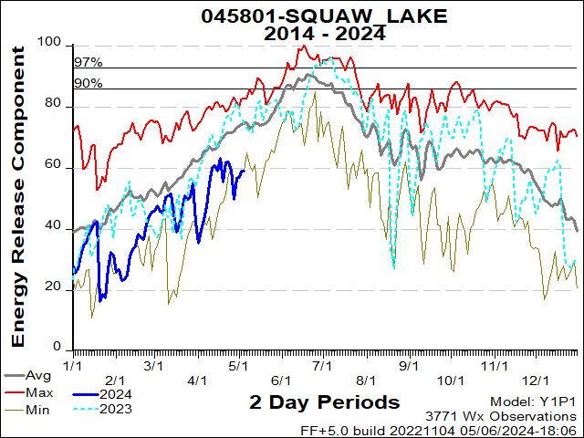
| 45801 | Senator Wash | FWS | IMR |
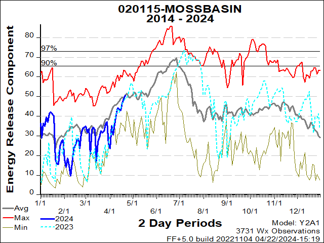
| 20115 | Moss Basin | BLM | KFO |
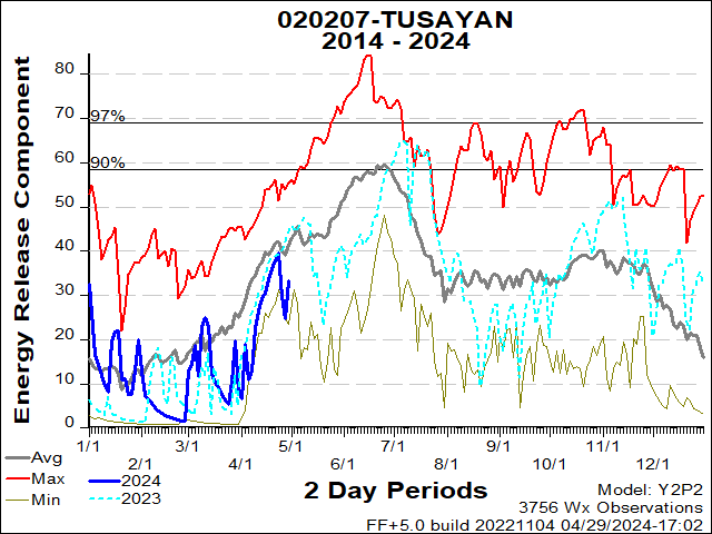
| 20207 | Tusayan | USFS | KNF |
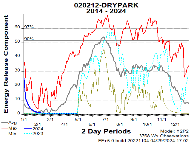
| 20212 | Drypark | USFS | KNF |
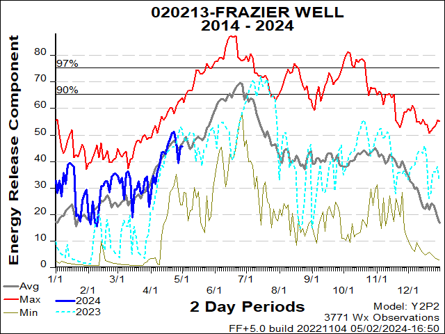
| 20213 | Frazier Well | BIA | TCA |
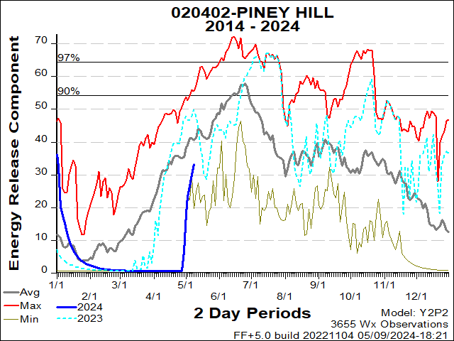
| 20402 | Piney Hill | BIA | NAA |
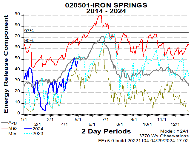
| 20501 | Iron Springs | USFS | PNF |
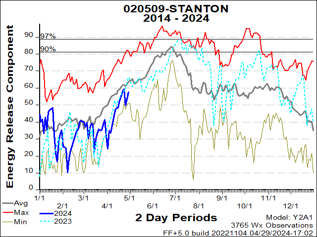
| 20509 | Stanton | BLM | PHD |
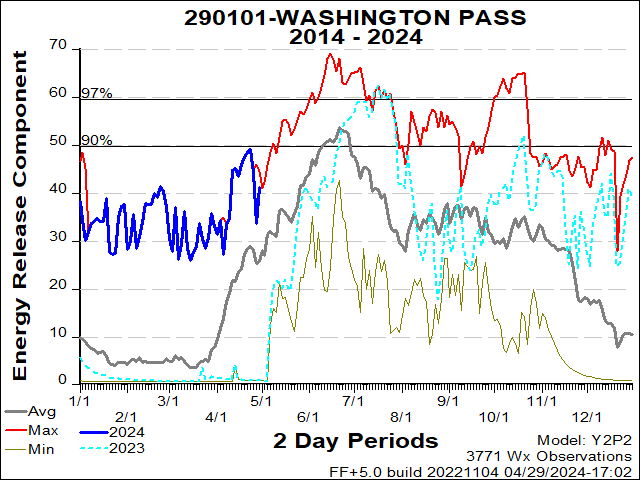
| 290101 | Washington Pass | BIA | NAA |
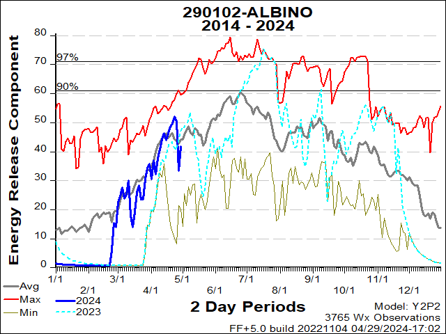
| 290102 | Albino Canyon | BLM | FAD |
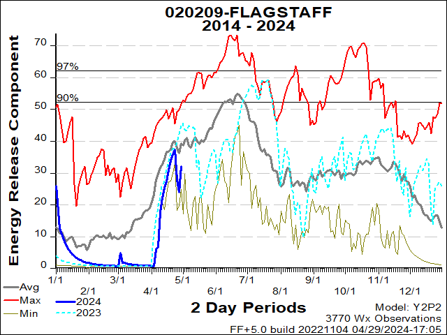
| 20209 | Flagstaff | USFS | COF |
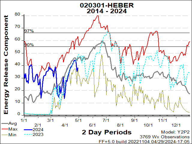
| 20301 | Heber | USFS | ASF |
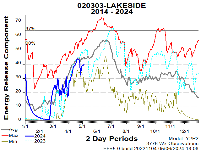
| 20303 | Lakeside | USFS | ASF |
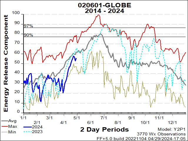
| 20601 | Globe | USFS | TNF |
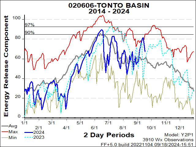
| 20606 | Tonto Basin | USFS | TNF |
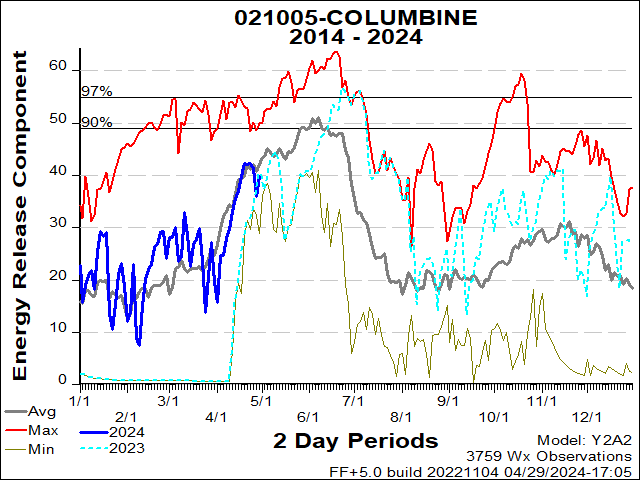
| 21005 | Columbine | USFS | CNF |
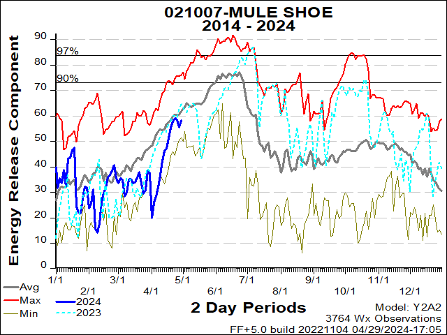
| 21007 | Mule Shoe | BLM | GID |
| 21202 | Saguaro | USFS | CNF |
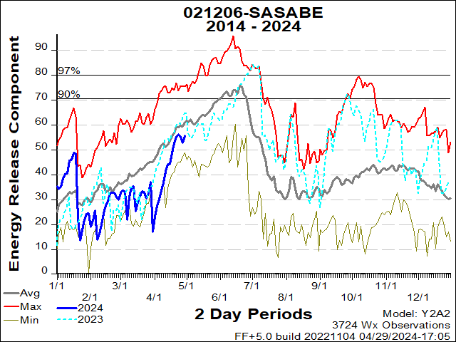
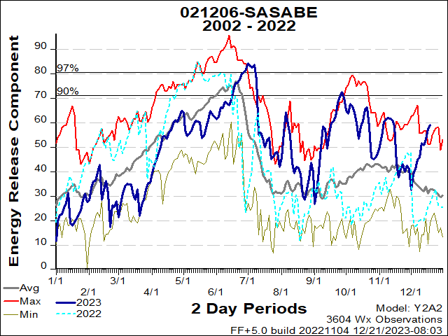
| 21206 | Sasabe | FWS | BAR |
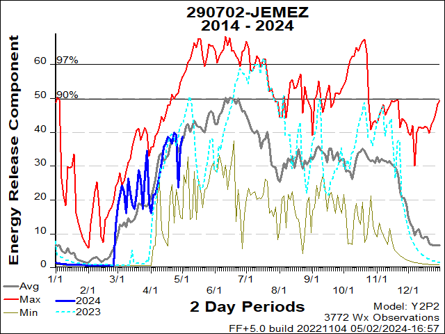
| 290702 | Jemez | USFS | SNF |
| 290801 | Tower | NPS | BAP |
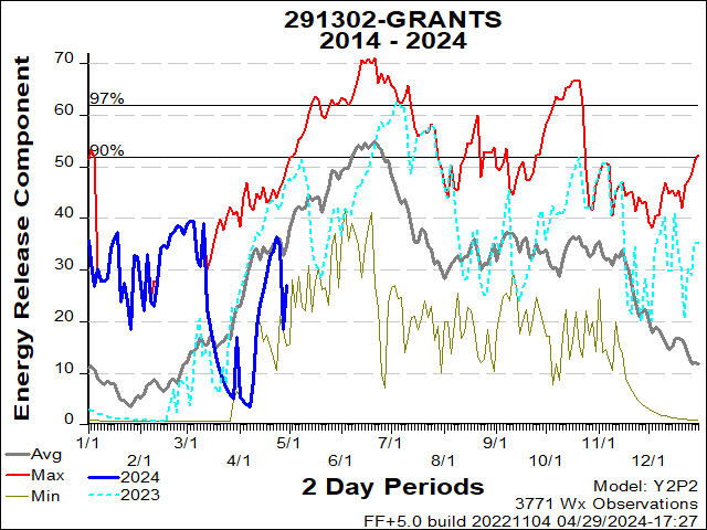
| 291302 | Grants | USFS | CIF |
| 20401 | Alpine | ||
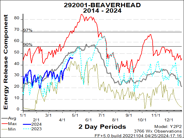
| 292001 | Beaverhead | USFS | GNF |
| 292008 | Slaughter Mesa | USFS | GNF |
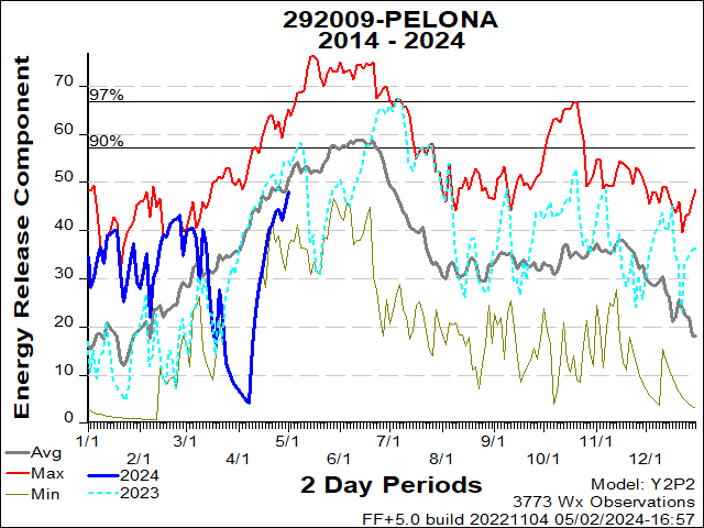
| 292009 | Pelona | BLM | SCD |
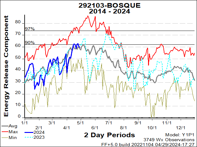
| 292103 | Bosque | FWS | BDR |
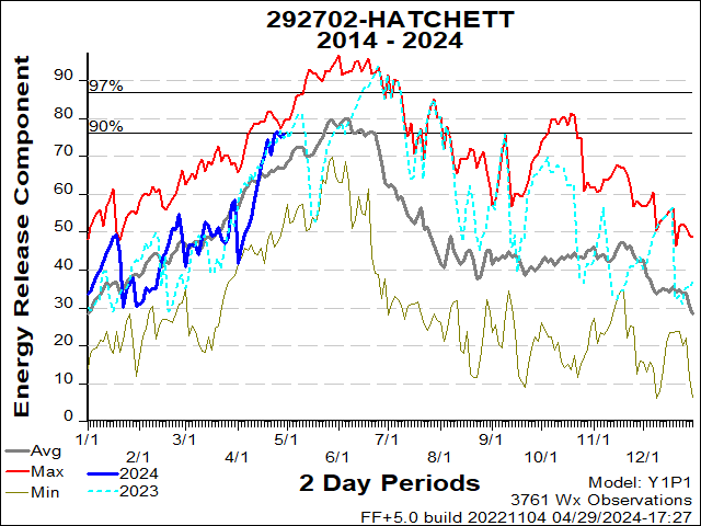
| 292702 | Hatchett | BLM | LCD |
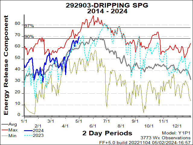
| 292903 | Dripping Springs | BLM | LCD |
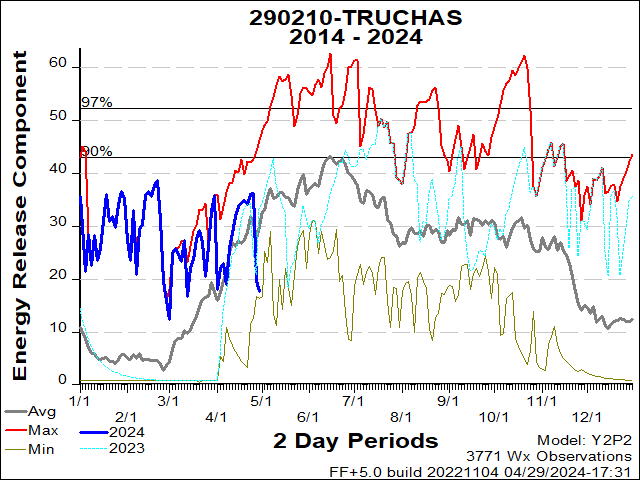
| 290210 | Truchas | USFS | CAF |
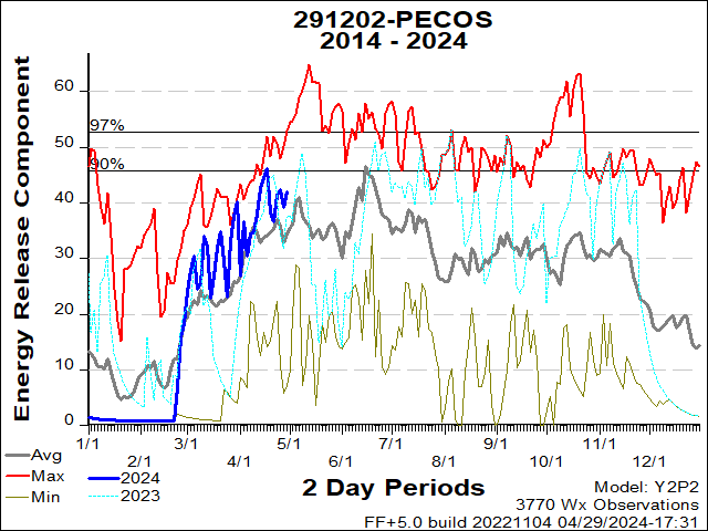
| 291202 | Pecos | USFS | SNF |
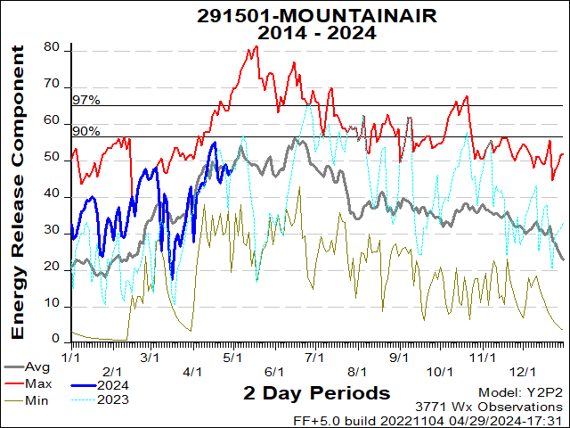
| 291501 | Mountainair | USFS | CIF |
| 292102 | |||
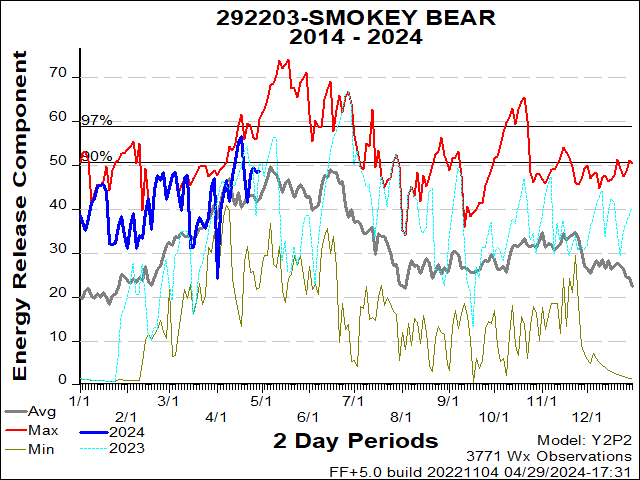
| 292203 | Smokey Bear | USFS | LNF |
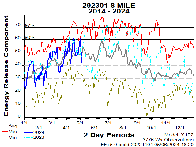
| 292301 | Eight Mile Draw | BLM | ROD |
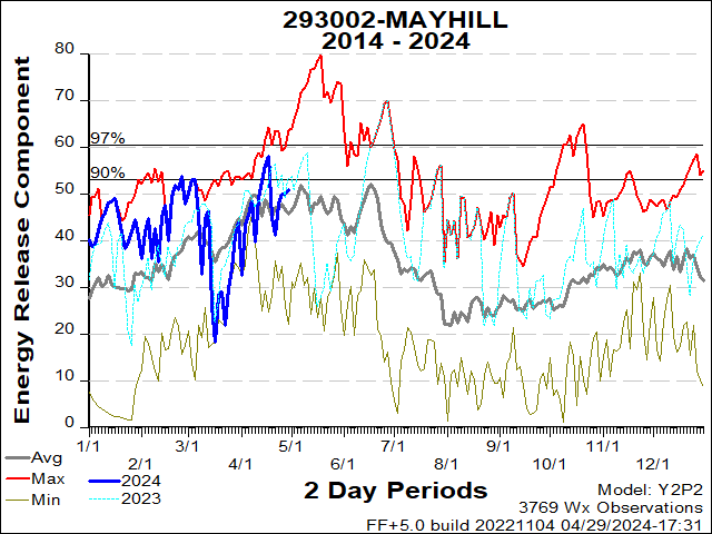
| 293002 | Mayhill | USFS | LNF |
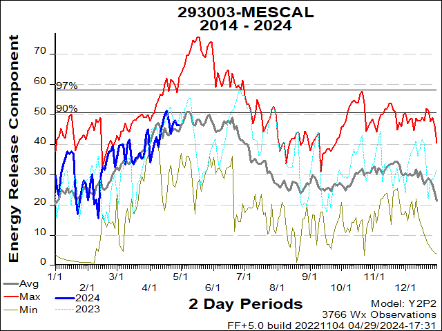
| 293003 | Mescal | BIA | MEA |
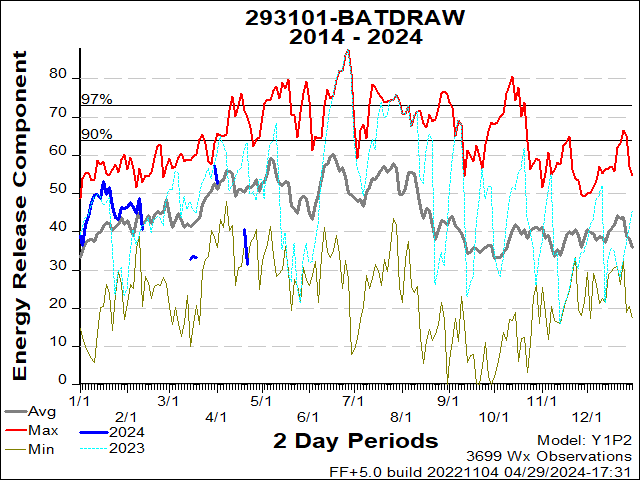
| 293101 | Batdraw | NPS | CCP |
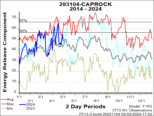
| 293104 | Caprock | BLM | ROD |
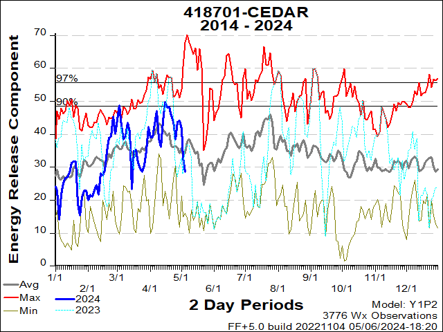
| 418701 | Cedar | NPS | LAP |
- SOUTHWEST COORDINATION CENTER
- 333 Broadway SE
- Albuquerque, NM 87102