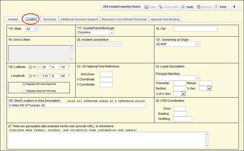
Much of the gIncident Location Informationh in Blocks 16.26 is optional, however derived from IRWIN. Completing as many fields as possible increases accuracy and improves interoperability and information sharing between disparate systems.
Wildfire incident location information is based on the point of origin of the incident. Non]fire incidents may be based on the incident jurisdiction.