Flight Hazzard Maps
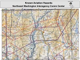
Colville National Forest Aviation Hazard Map
|
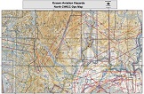
North CWICC Ops Aviation Hazard Map |
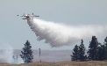
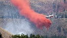
 If You Fly We Can't. DRONES NEAR WILDFIRES ARE NOT SAFE! |
National | NWCC Home | About Us | Site Disclaimer | Site Index | Contact Us


This is a US Government Computer System; before continuing, please read this Disclaimer, as well as our Privacy Policy.