
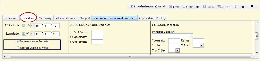
Block 22. Latitude/Longitude 

Enter the Latitude and Longitude of the incident at the point of origin. Make sure the correct Lat/Long format is selected (degrees, minutes and seconds, or degrees decimal minutes). Confirm the Lat/Long entered is expressed in datum NAD83.
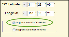
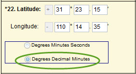
In the example above, the same coordinate location is expressed in degrees, decimal minutes (left), and degrees, minutes and seconds (right). Notice the difference in the numbers. It is important to know which format your coordinates are in before entering them into the application.
Block 23. US National Grid Reference
Enter the US National Grid Reference corresponding to the incident’s point of origin as expressed in NAD83 data format, if available and commonly used by the agencies/jurisdictions with primary responsibility for the incident.
Block 24. Legal Description (Public Land Survey System – PLSS)
Enter the legal description (section, township, range) of the incident’s point of origin, if available and commonly used by the agencies/jurisdictions with primary responsibility for the incident. Principle Meridian must correspond to that state.