Welcome to LPCC!
 Los Padres Communications Center (LPCC) provides All-Risk Dispatching services to USDA Forest Service-Los Padres National Forest, Department of Fish and Wildlife-Hopper Mountain and Bitter Creek Refuges, Santa Ynez Band of Chumash Mission Indians, and Initial Attack and Expanded Dispatch services for "fire related" incidents happening on National Park Service-Channel Islands National Park (San Miguel, Santa Rosa, Santa Cruz, Anacapa, San Nicholas, and Santa Barbara Islands), Bureau of Reclamation-Lake Casitas and Lake Cachuma, and the Department of Defense-Vandenberg Space Force Base and Fort Hunter Ligget Army Training Base.
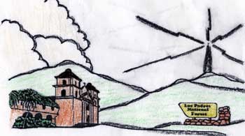
Los Padres ("The Fathers") National Forest encompasses nearly two million acres on the beautiful Coast and Transverse Mountain Ranges of Central California. The Forest stretches across 220 miles North to South, from the spectacular Big Sur Coast in Monterey County to the Western edge of Los Angeles County and includes two separate land divisions. Elevations in the Forest range from sea level to 8,800 feet. Los Padres is often thought of as "brush country", but in fact consists of an amazing variety of landscapes. Major ecosystems include chaparral, oak woodland, mixed conifer, coastal redwood, grassland, pinyon-juniper, semi-desert scrub and riparian.
Los Padres National Forest resides in five counties - Monterey, San Luis Obispo, Santa Barbara, Ventura, Kern, and borders Los Angeles County on the Southwest end of the forest. With this land mass it requires multiple cooperative agreements along with extensive incident, frequency, aviation, and logistical coordination adding to the complexities of the mobilization efforts in this dispatch center. The proximity of the Forest places the FIRE operation in two CalFire Ranger Units and Regions, four Contract Counties, and three Operation of Emergency Service (OES) operational areas, along with five city fire departments Local Response Areas (LRA's) parallel to Los Padres Federal Response Areas (FRA's). Fire locations drive which of four Air Tanker Base operations the center will utilize during fire suppression efforts. In addition, we are the host dispatch center to the Modular Airborne Fire Fighting System (MAFFS) when activated at Pt. Magu.
All Risk incidents also require LPCC to coordinate with five Sheriff Departments, four California Highway Patrol offices, Cal Trans and County Roads Operations, California State Fish and Game, Police Departments, Volunteer Fire Departments and a multitude of dispatch centers.
Los Padres Communications Center mobilizes 25 Type 3 Engines, 3 Interagency Hotshot Crews, two Type 2 Hand Crews, 2 dozers, 3 water tenders, 13 Patrol Units (Type 6 and 7 Engines), 3 Type 2 Helicopters, 1Type 1 Helitanker, 1 Air Attack, over 200 pieces of VIPR (contract) equipment, and a multitude of overhead militia. LPCC is also the expanded dispatch conduit for the mobilization of our cooperator resources to federal incidents on and off the Forest.
We hope you have the opportunity to visit Los Padres National Forest and thank you for taking a moment to visit our website.
