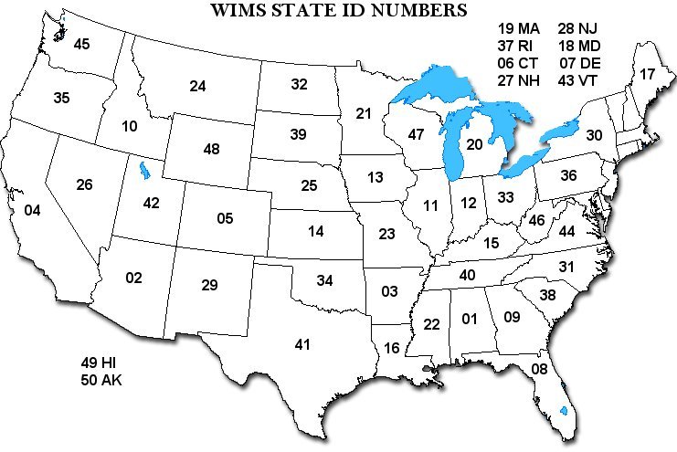
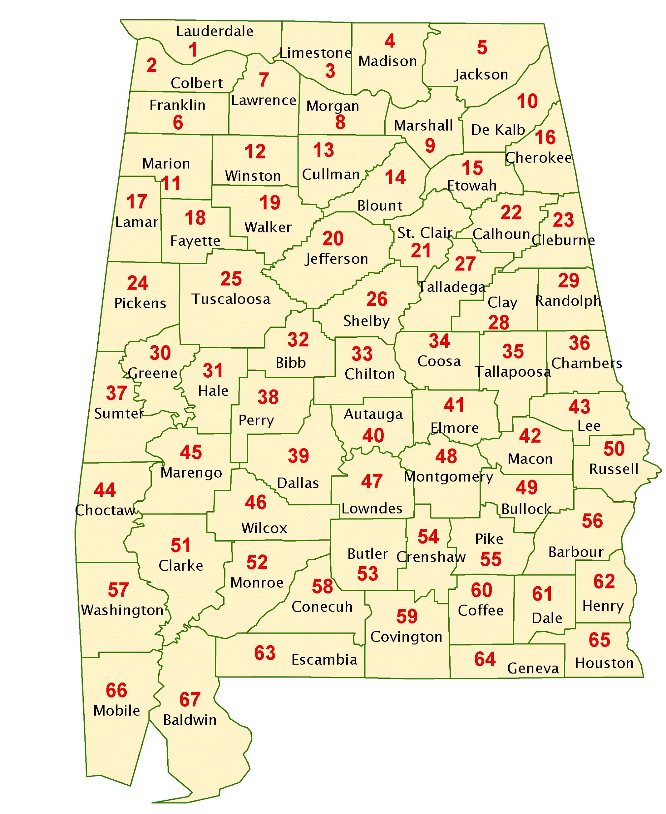
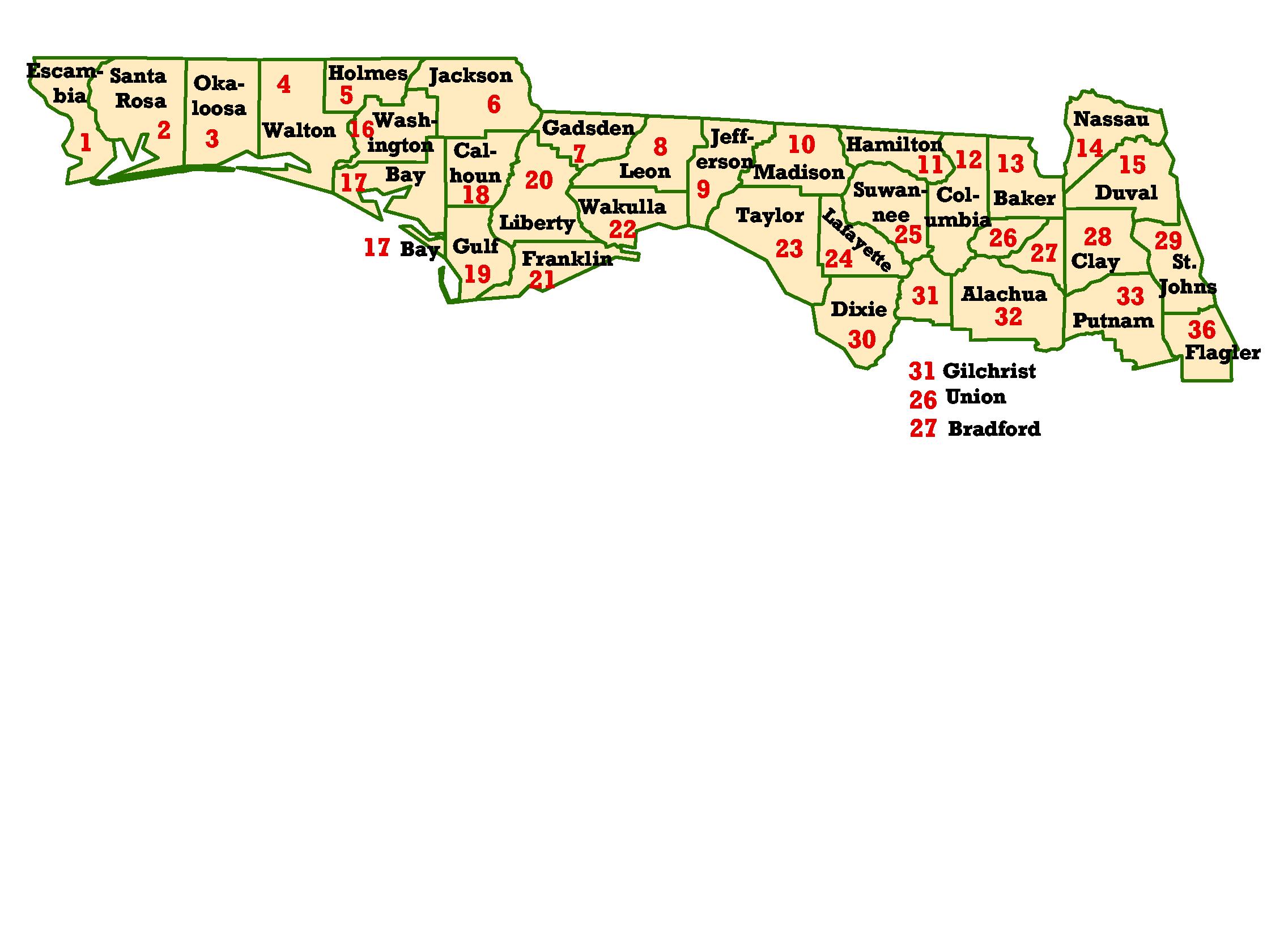
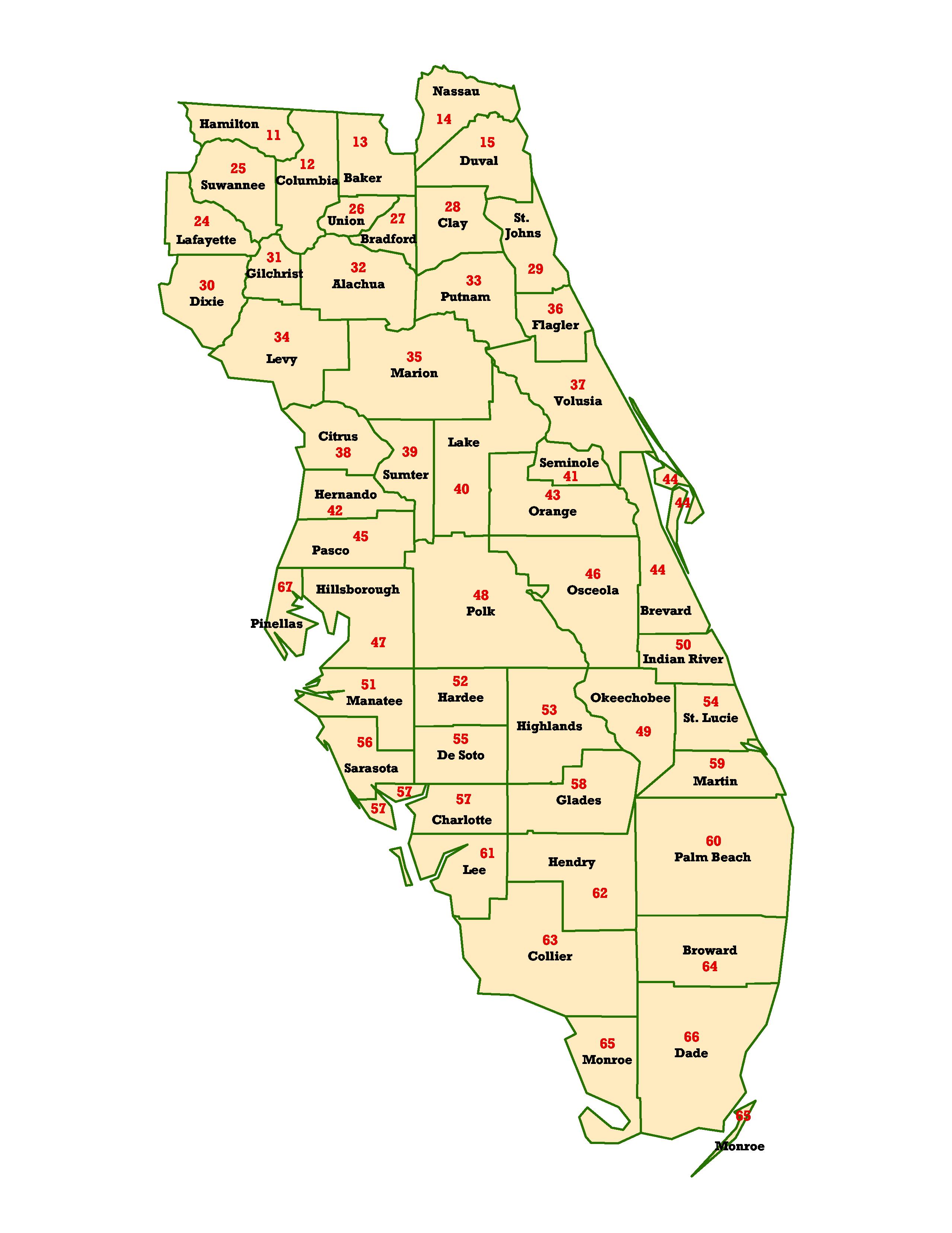
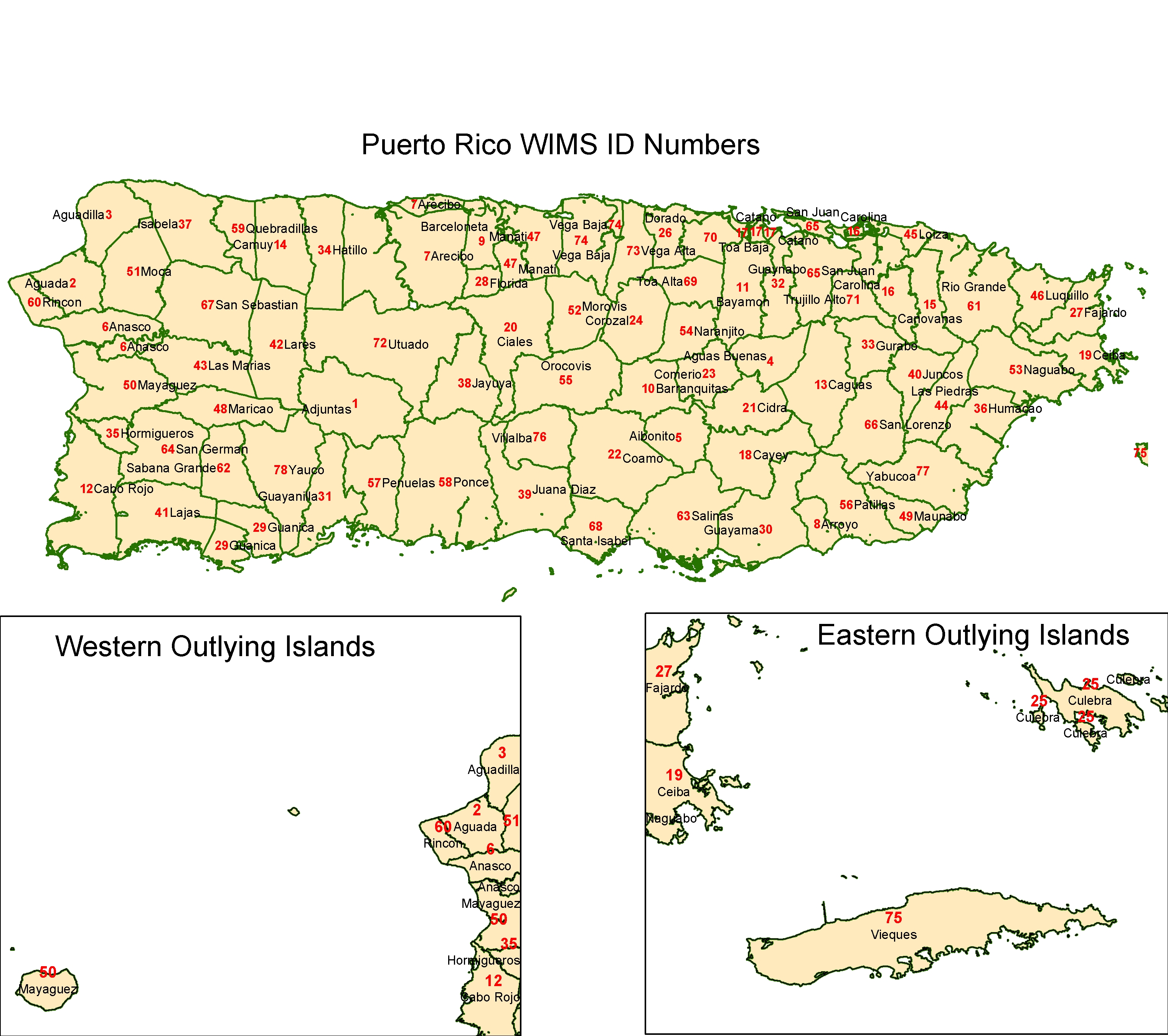
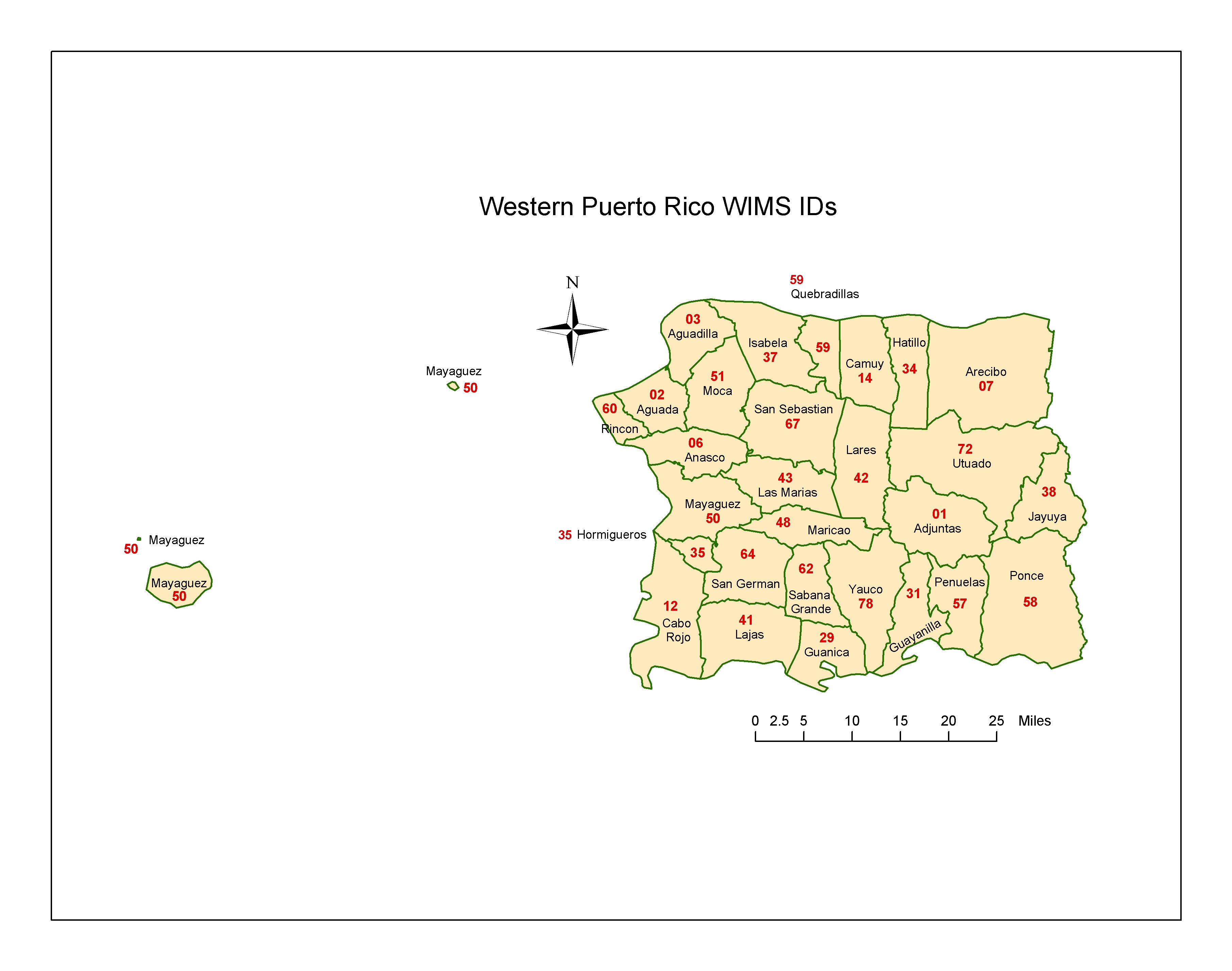
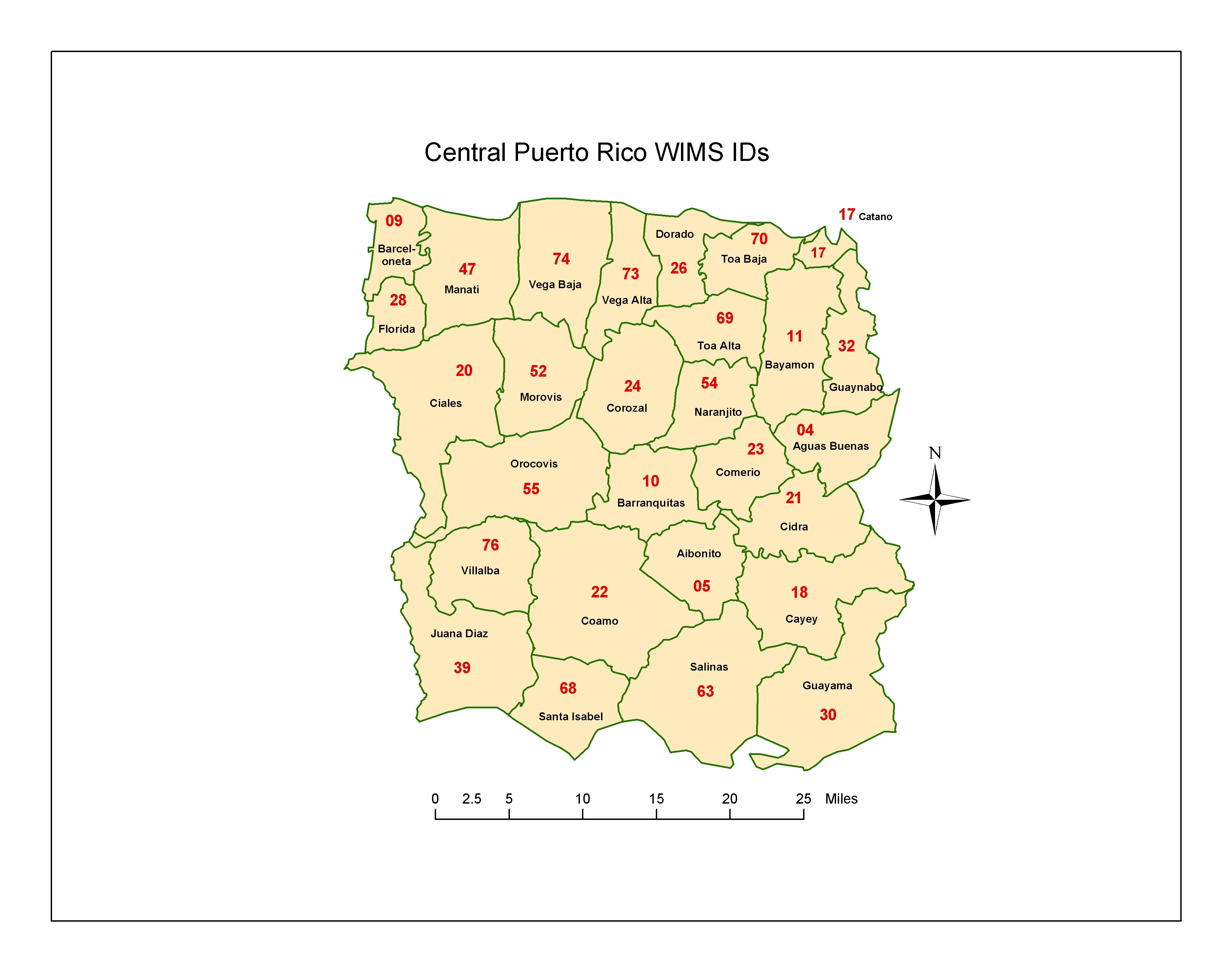
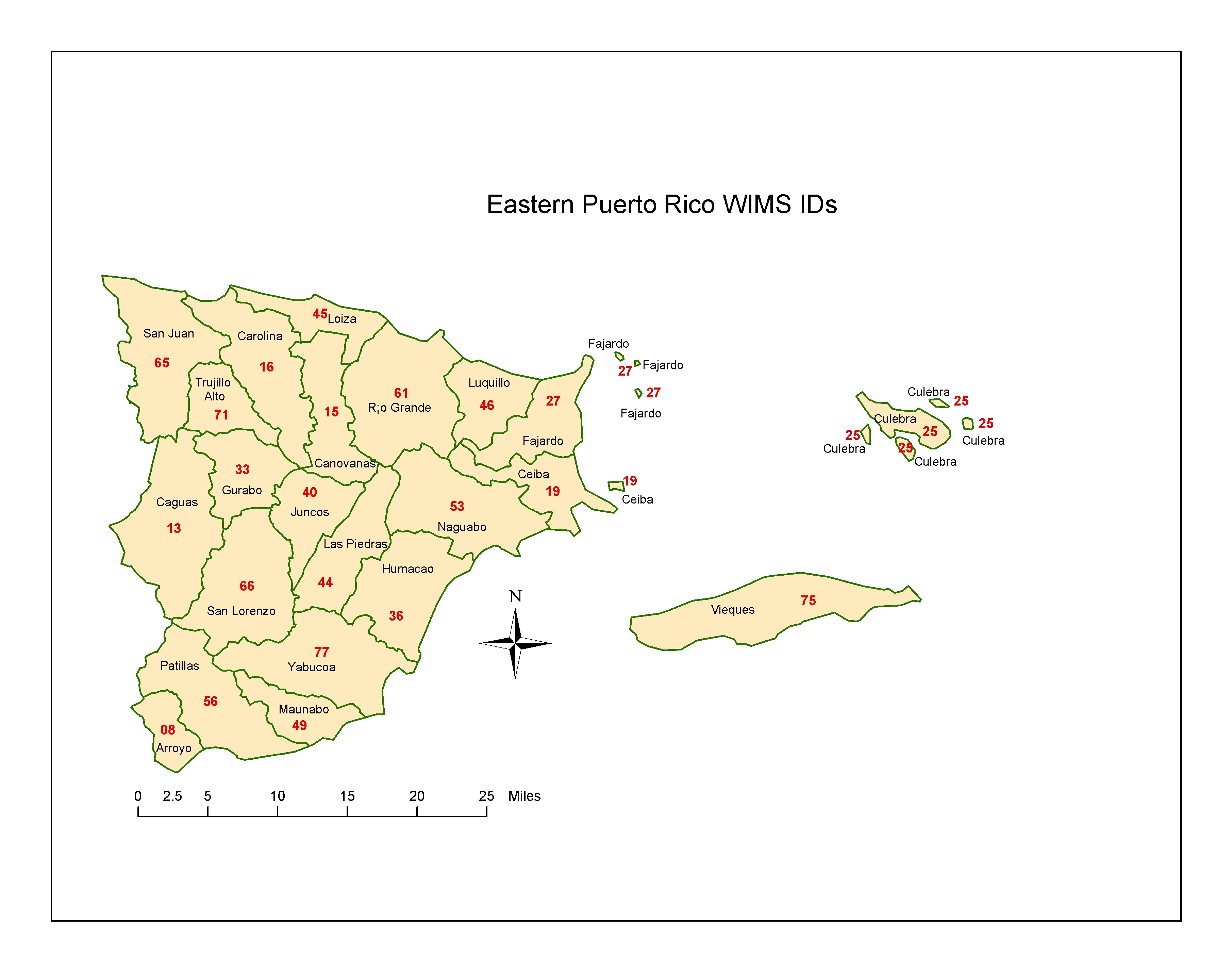
WIMS County ID Maps
These maps
have been designed by the SACC Predictive Services Team to help our users in
the field identify themselves in the “WIMS world”. Each state, or portion of a
state, has been clearly labeled with the county name and the WIMS County
ID number. WIMS ID
numbers should not be confused with county “Z” numbers that are used by the
National Weather Service to demarcate zones. WIMS ID numbers do not follow county FIPS
codes in all areas, although they may utilize the County FIPS
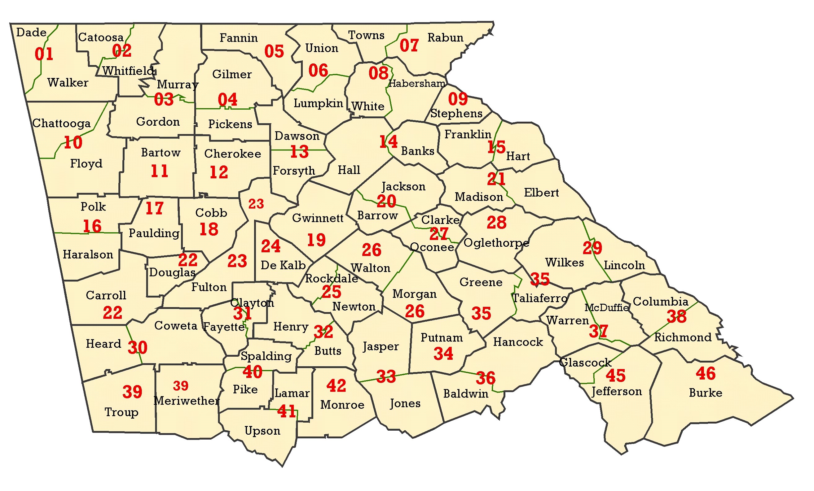
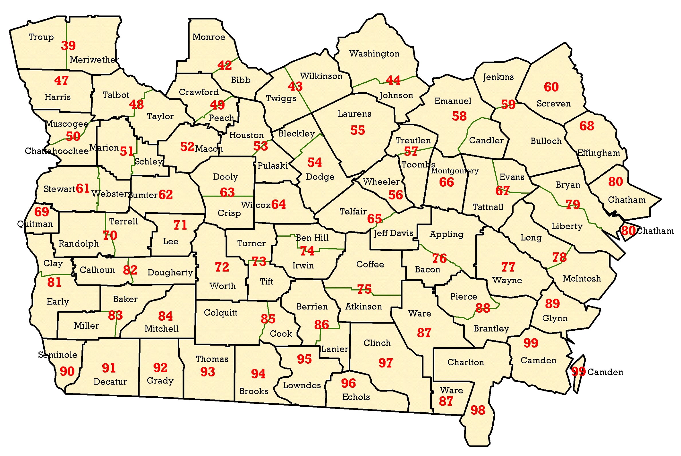
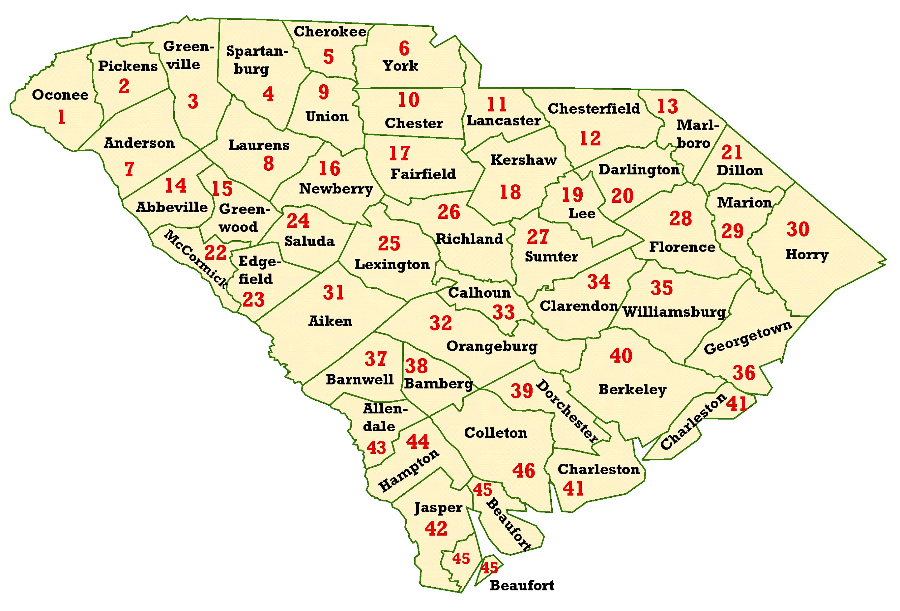
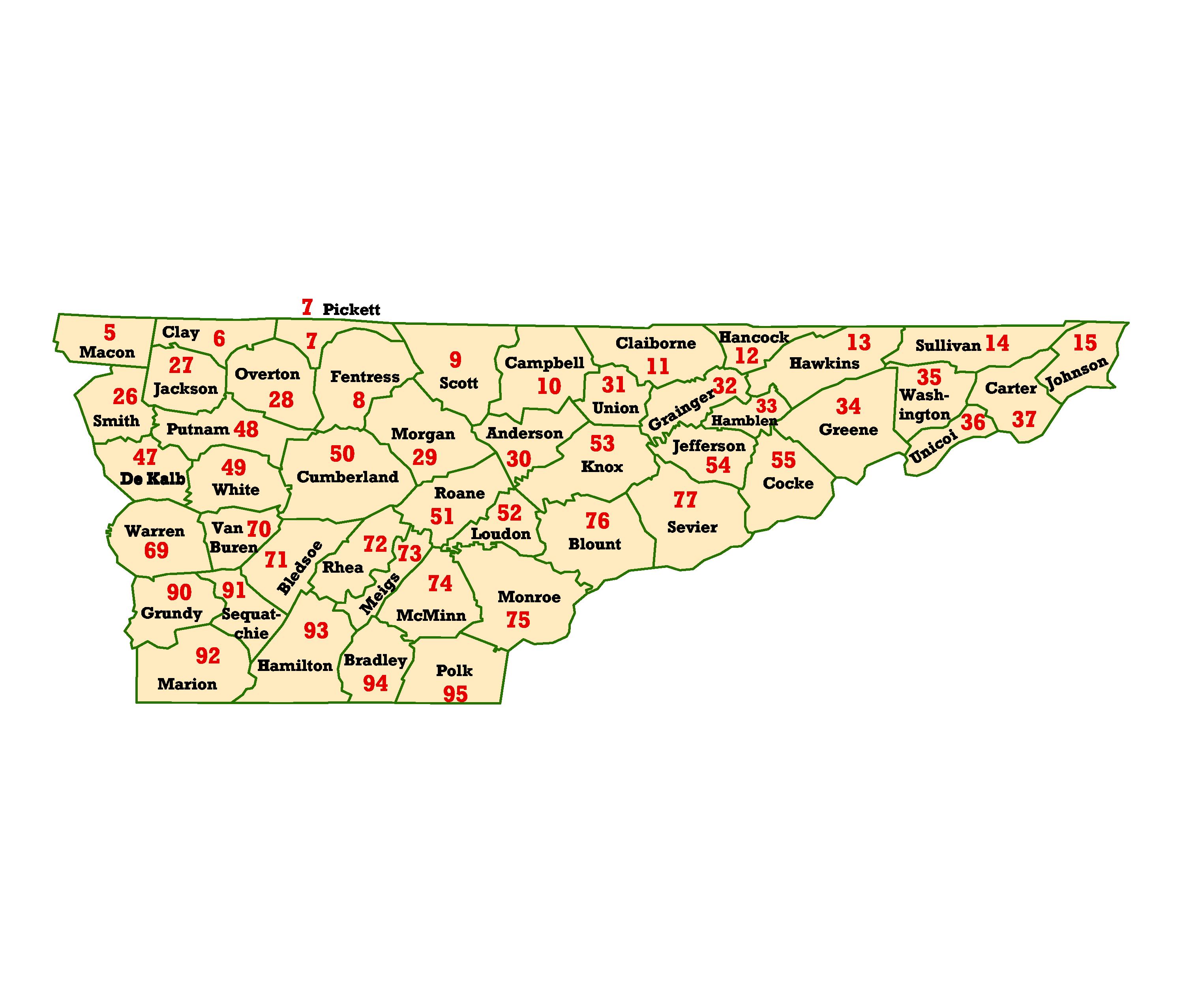
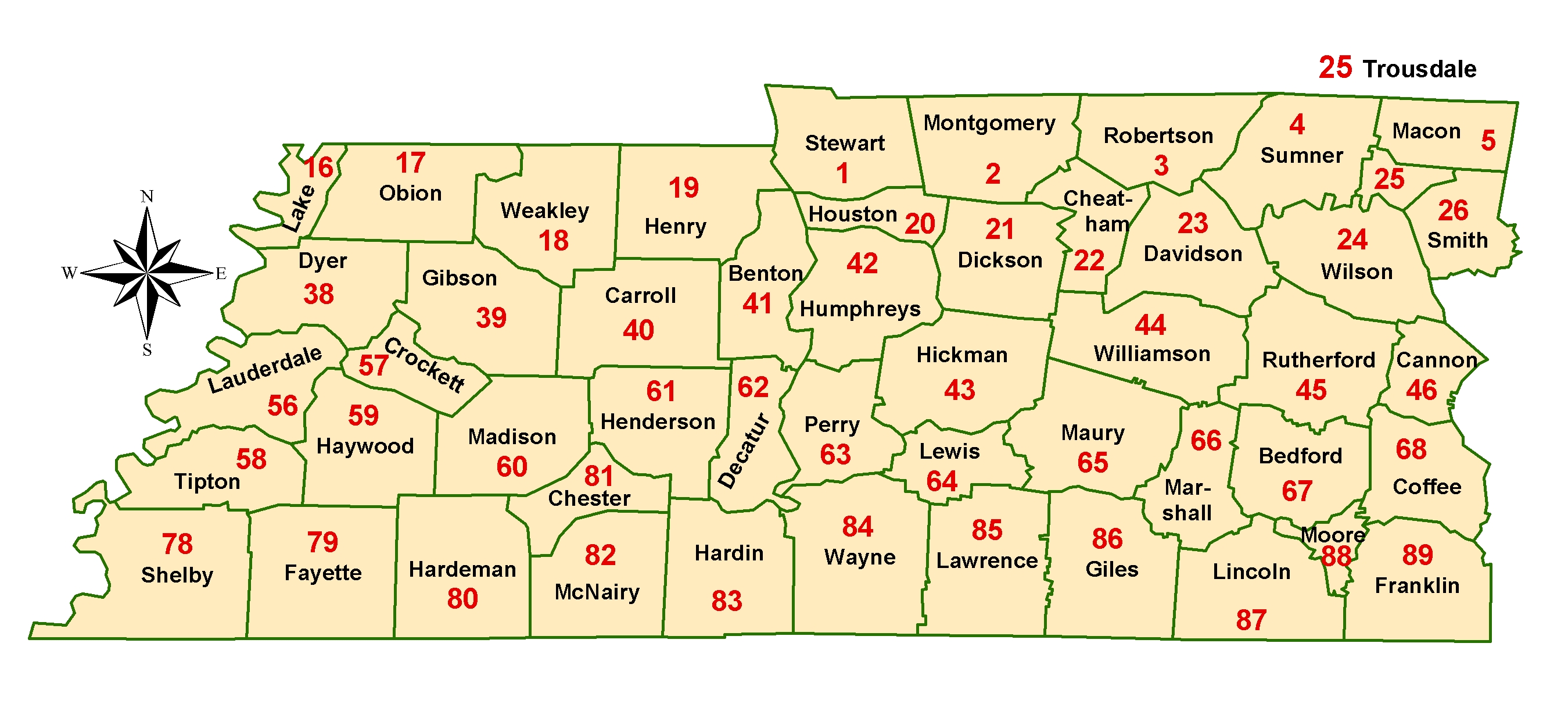
code in some areas. The WIMS convention is a 2-digit state code,
followed by a 2-digit county code, followed by a 2-digit station number. These
maps were designed to help those who have oversight of RAWS to quickly and
easily identify new station numbers. If you put in a new station, or need to
move a station, please contact SACC for a new WIMS ID.
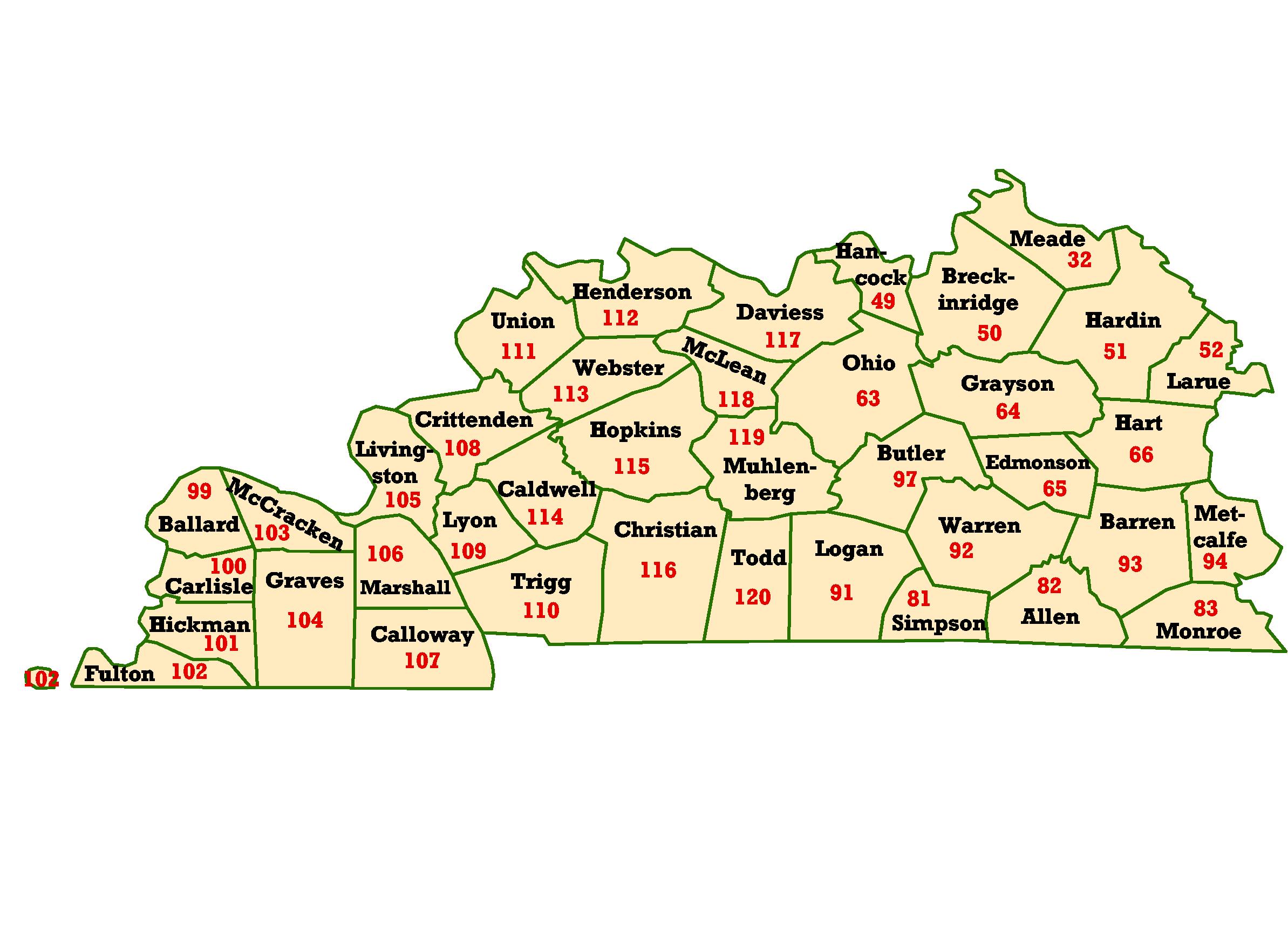
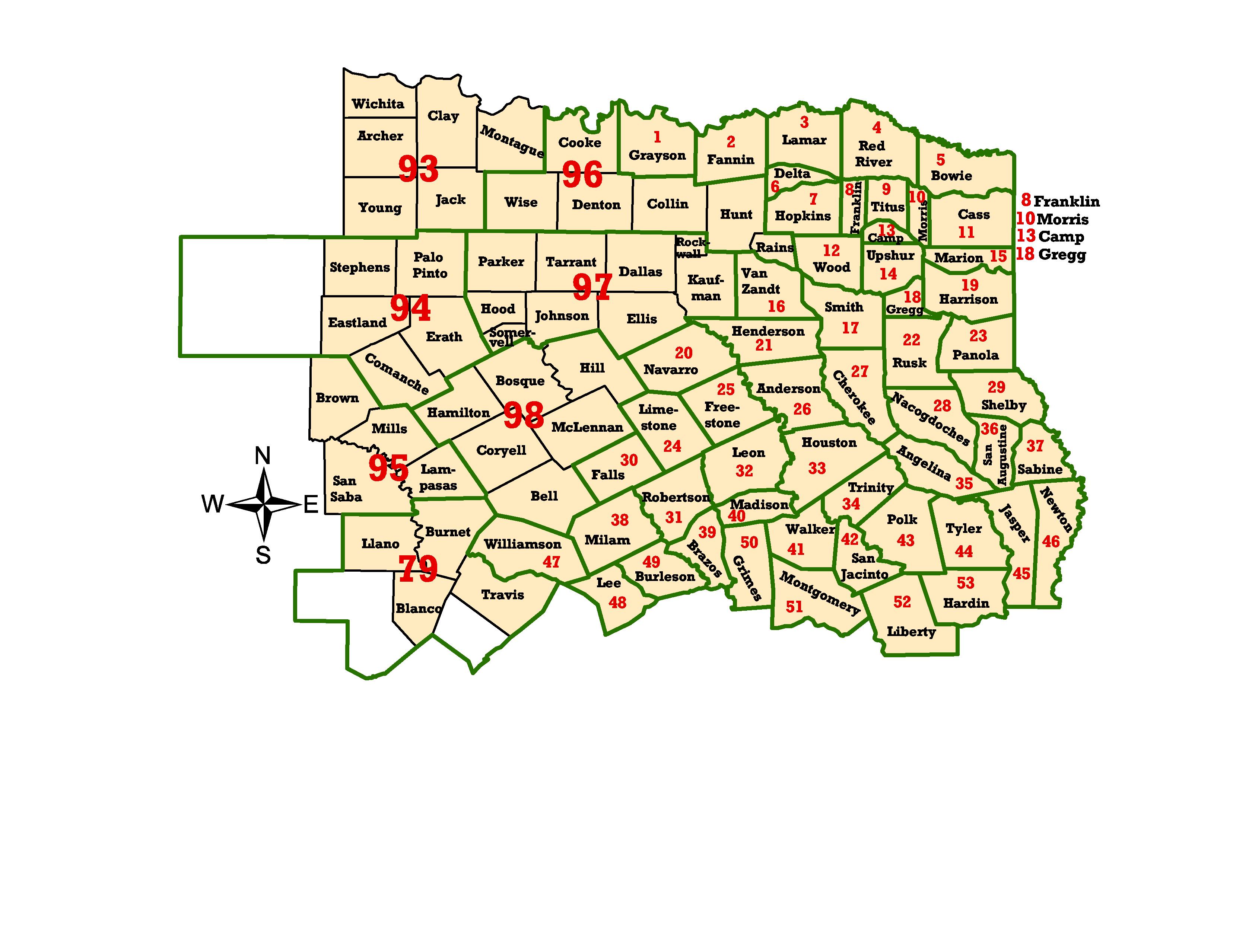
WIMS
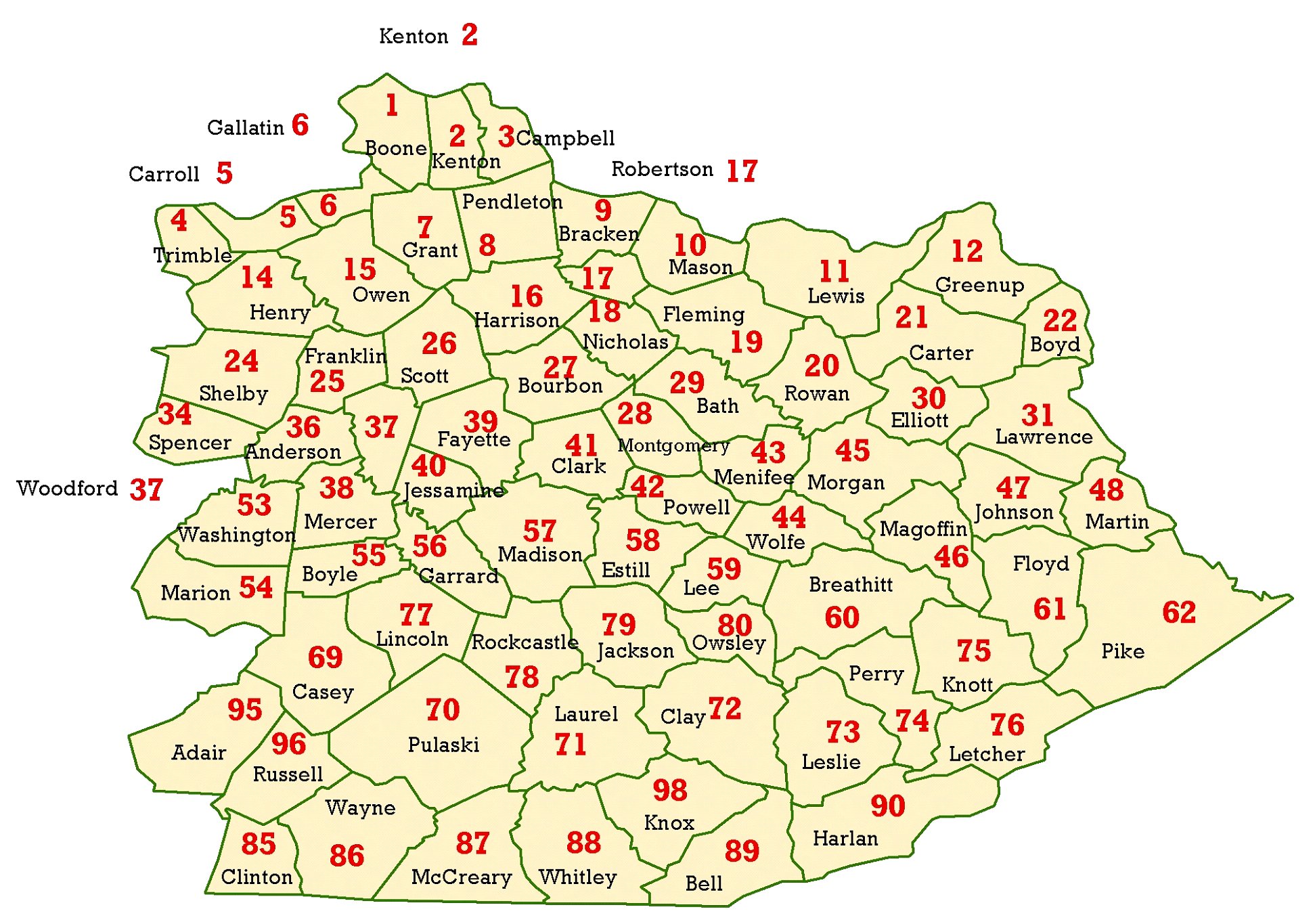
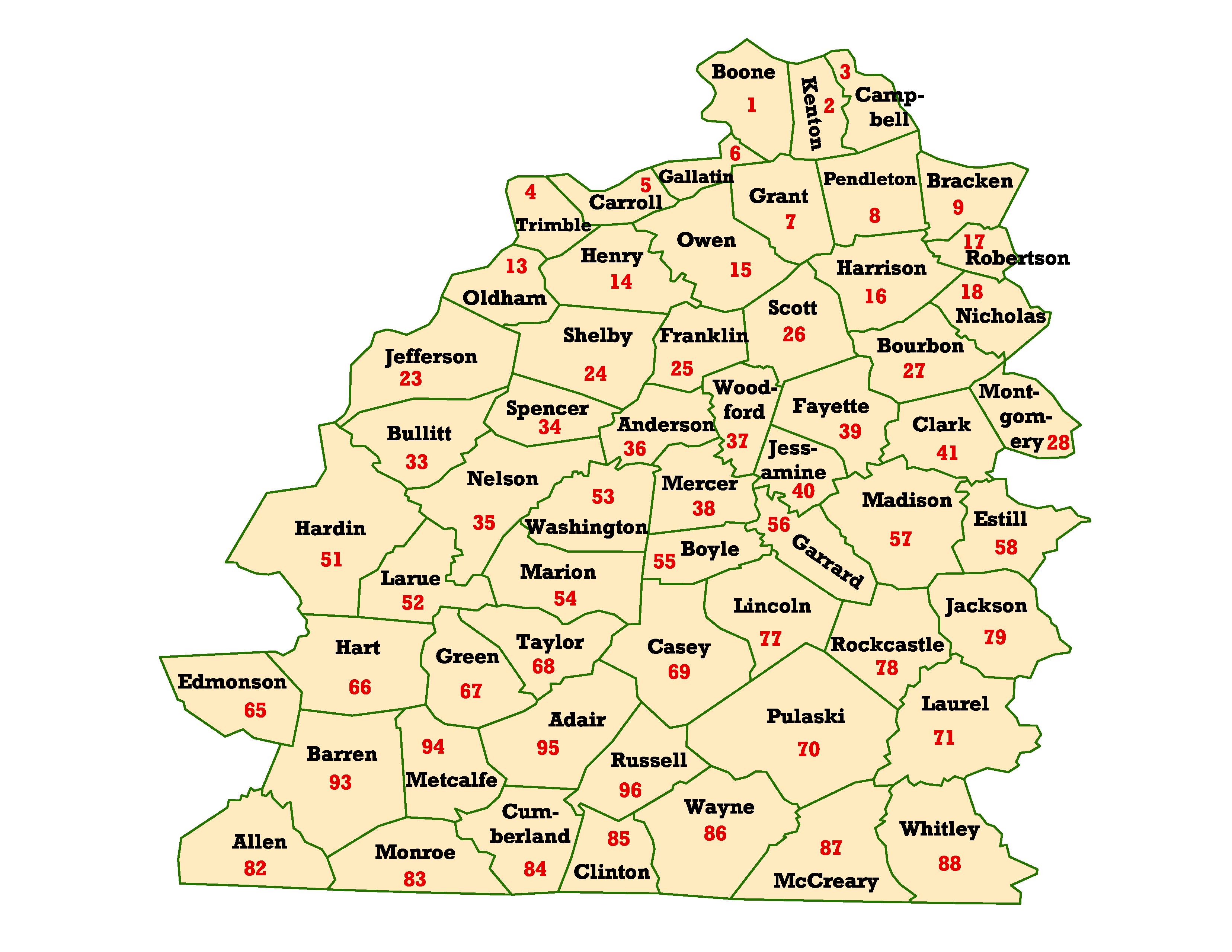
Convention Example: 15 70
02 Corresponds to: Kentucky
(15)--Pulaski County (70)--Station number 02 in the
county. Station number is 157002
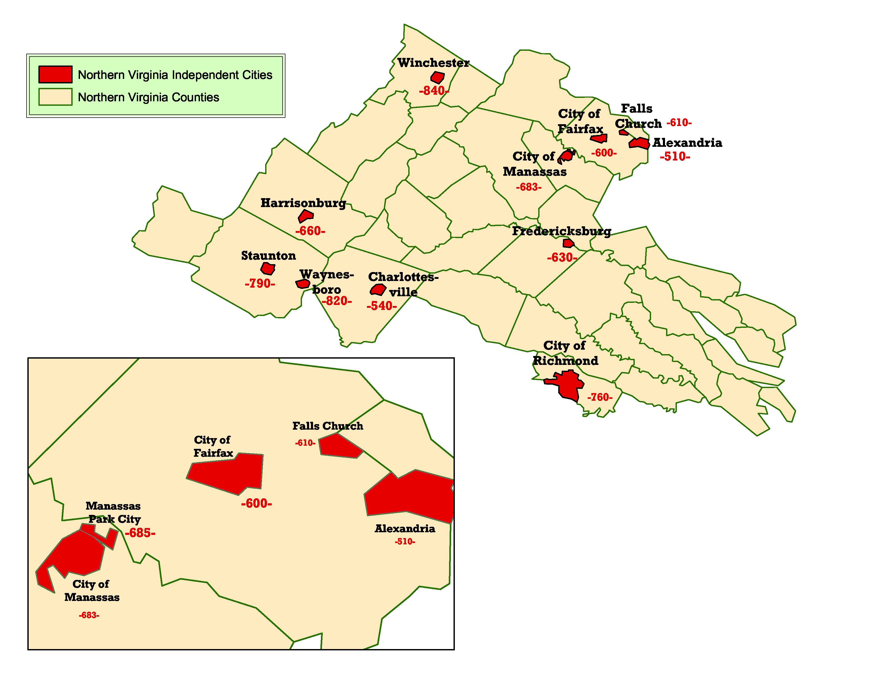
For Virginia,
and much of the northeast, this convention breaks down. When the number of counties in a state exceed 99, counties are
clustered into groups. Georgia
and Texas
exhibit this concept.
These maps
are free, average about 1.6MB apiece, and are created using 301 dpi. They should
maintain their clarity and resolution when resized. Everyone should feel free
to incorporate these maps into their Annual Operating Plan as they deem
appropriate
A
PowerPoint Presentation of all available maps is available for download. It is
81.5 MB in size! Right Click here and choose Save As
or Save Target As for the unzipped version. The zipped version
(75.2 MB) is also available for download.
If you find
errors, please email me at denver_ingram@nps.gov. Thanks. Denver.
NATIONAL WIMS STATE
CODES MAP
Alabama
Arkansas
Florida
Florida Panhandle
Florida Peninsula
Georgia
North Georgia
South Georgia
Kentucky
Eastern Kentucky
Central Kentucky
Western Kentucky
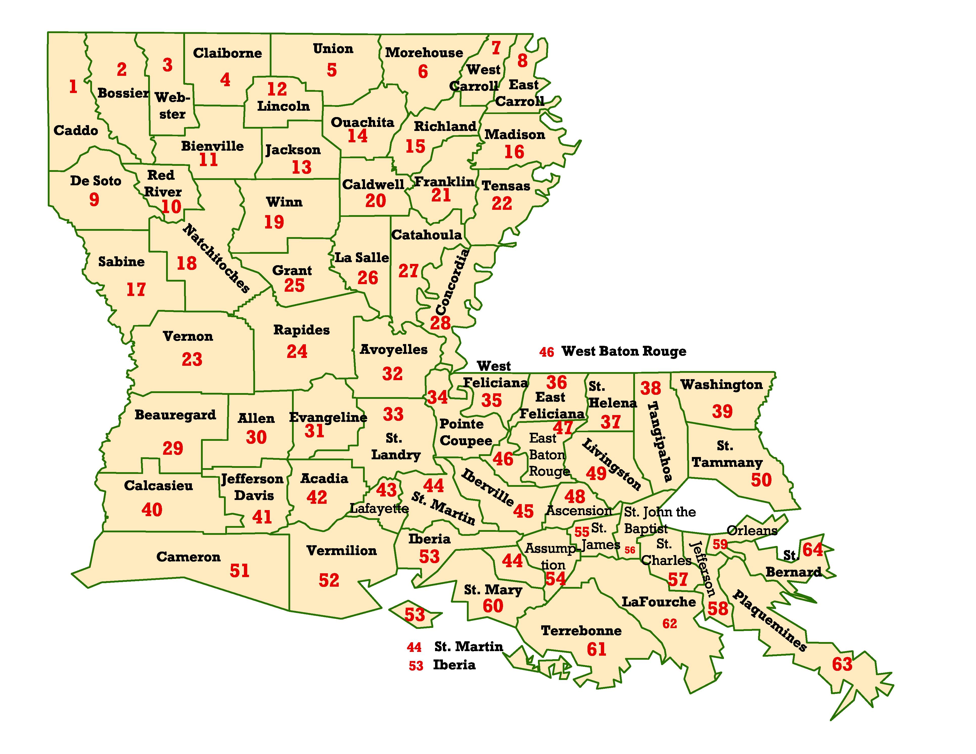
Louisiana
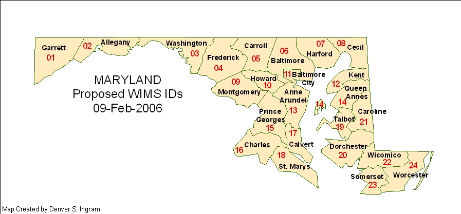
Maryland
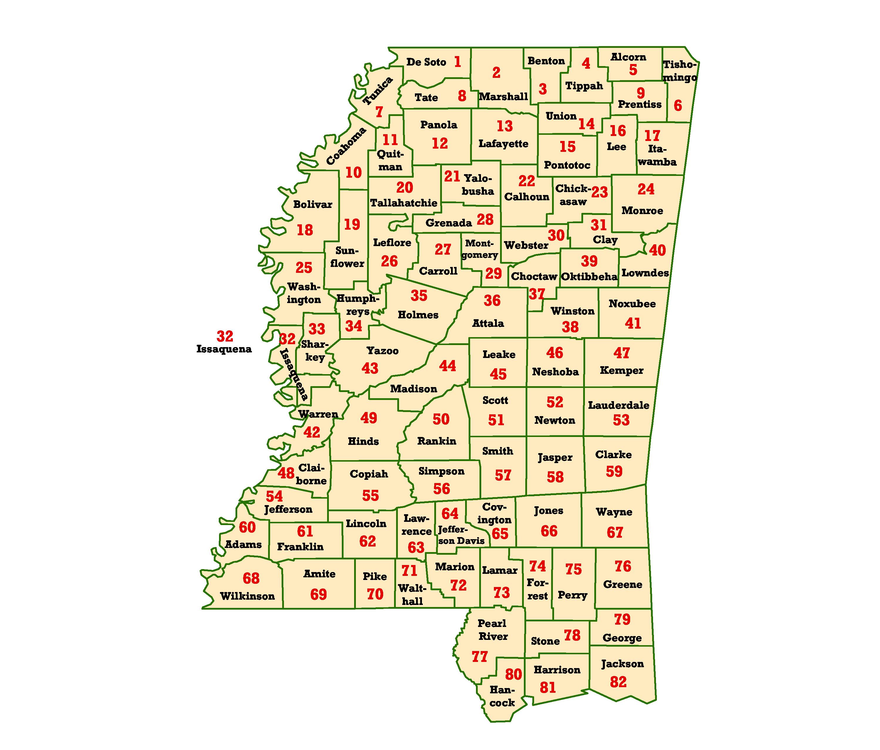
Mississippi
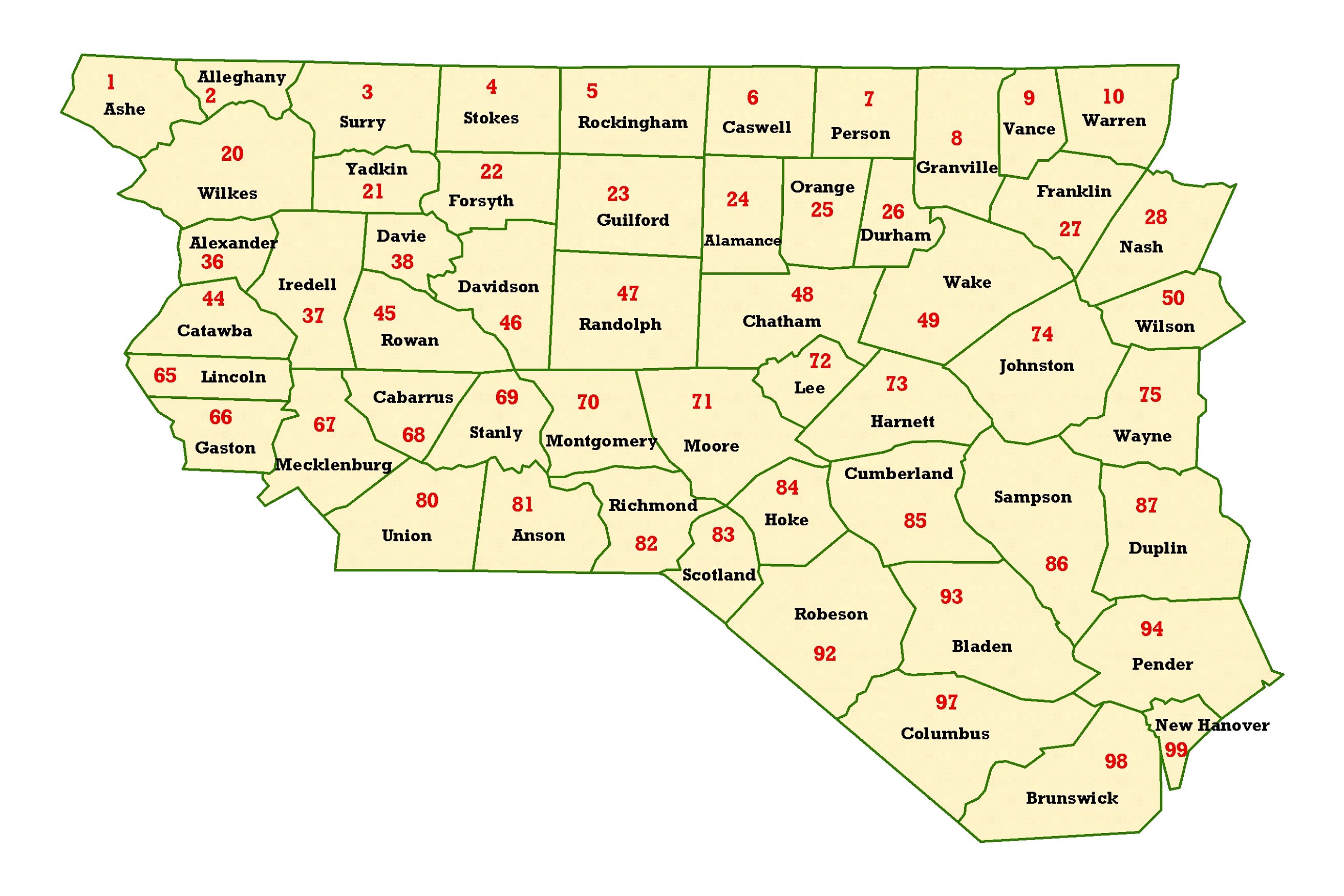
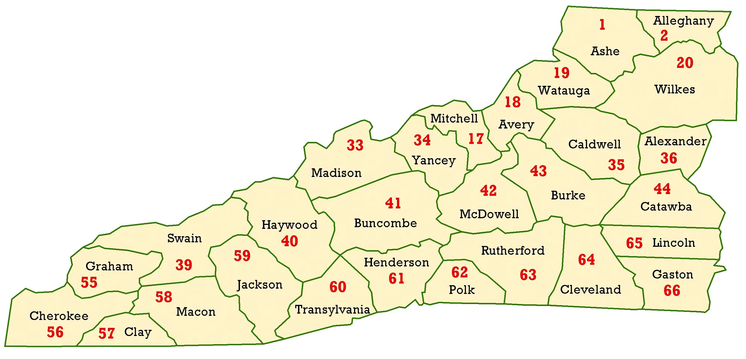
North Carolina
Eastern North Carolina
Central North Carolina
Western North Carolina
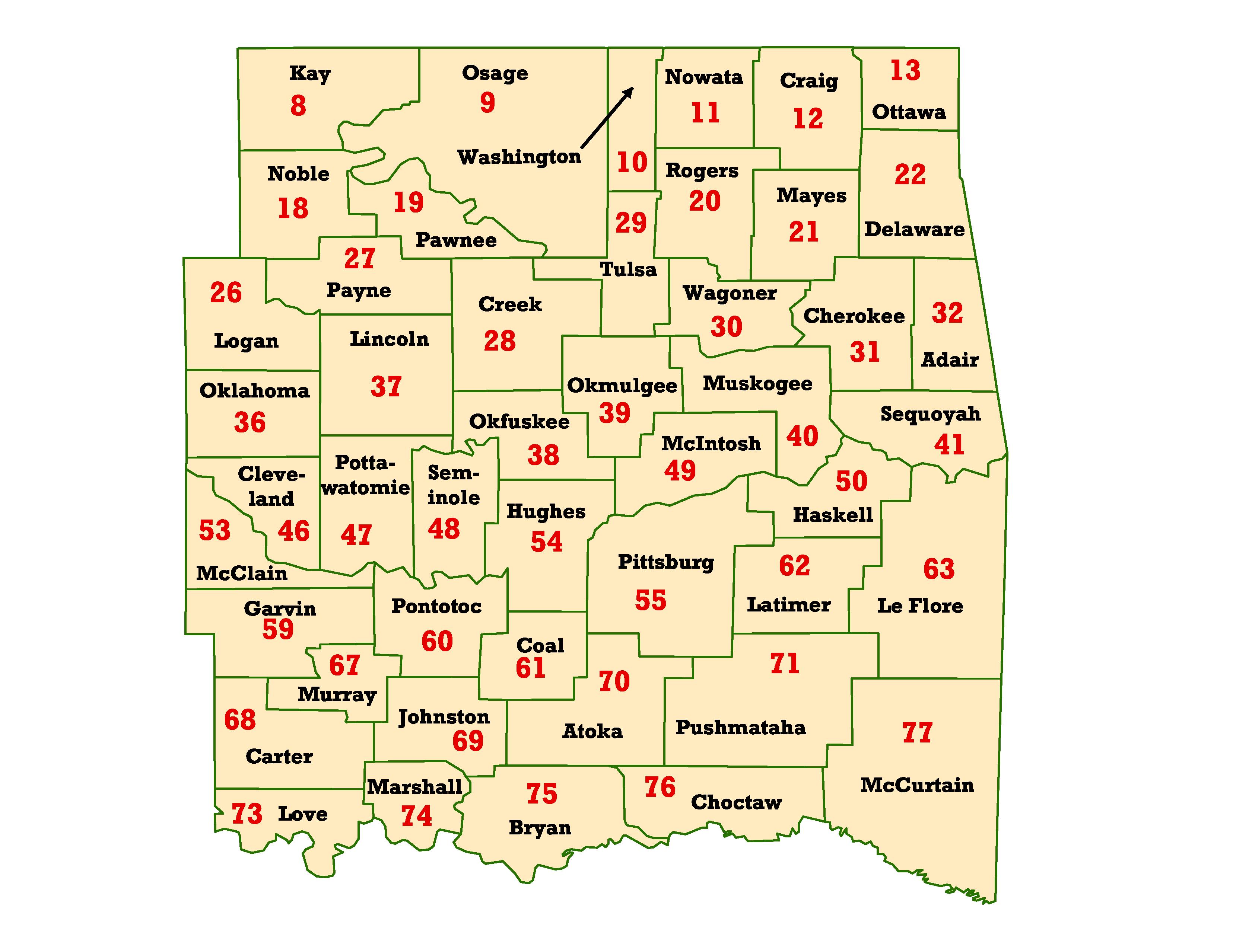
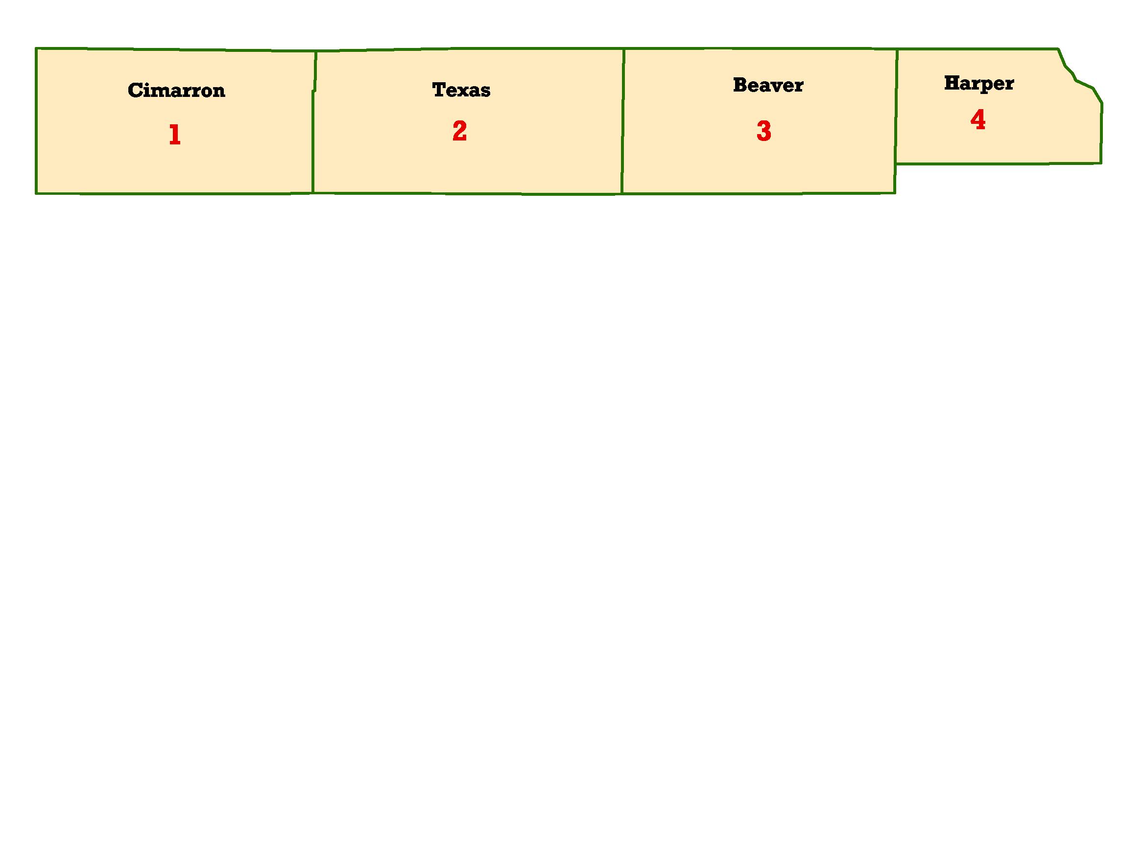
Oklahoma (Now Available)
Eastern Oklahoma
Western Oklahoma
Oklahoma Panhandle
Puerto
Rico (est. 5-18-05)
Western Puerto Rico
Central Puerto Rico
Eastern Puerto Rico
South Carolina
Tennessee
Eastern Tennessee
Western Tennessee
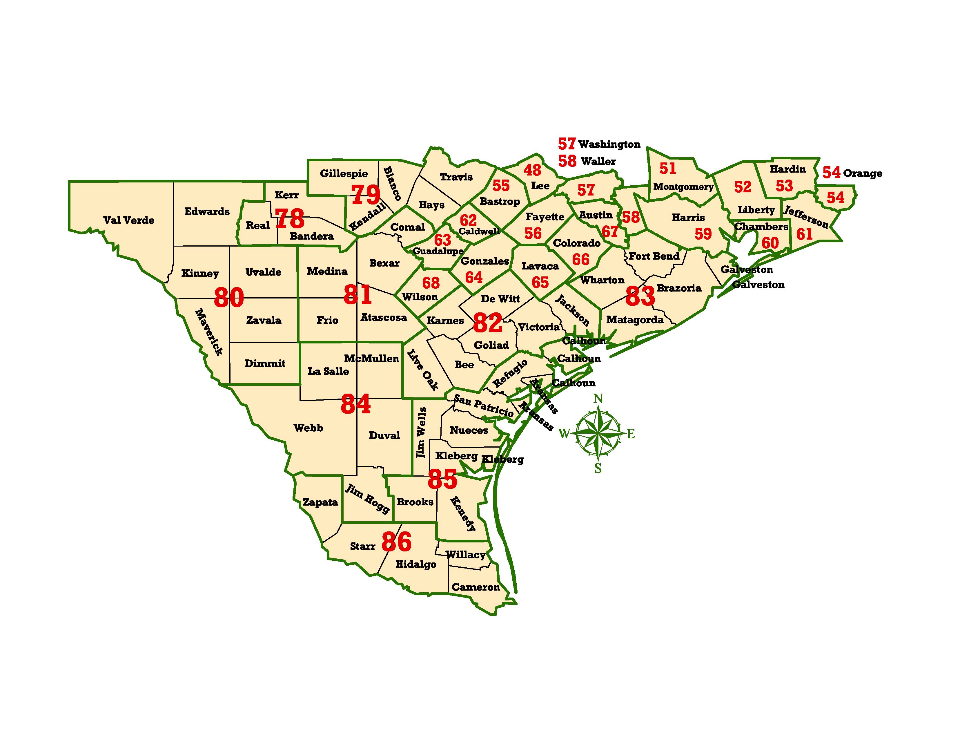
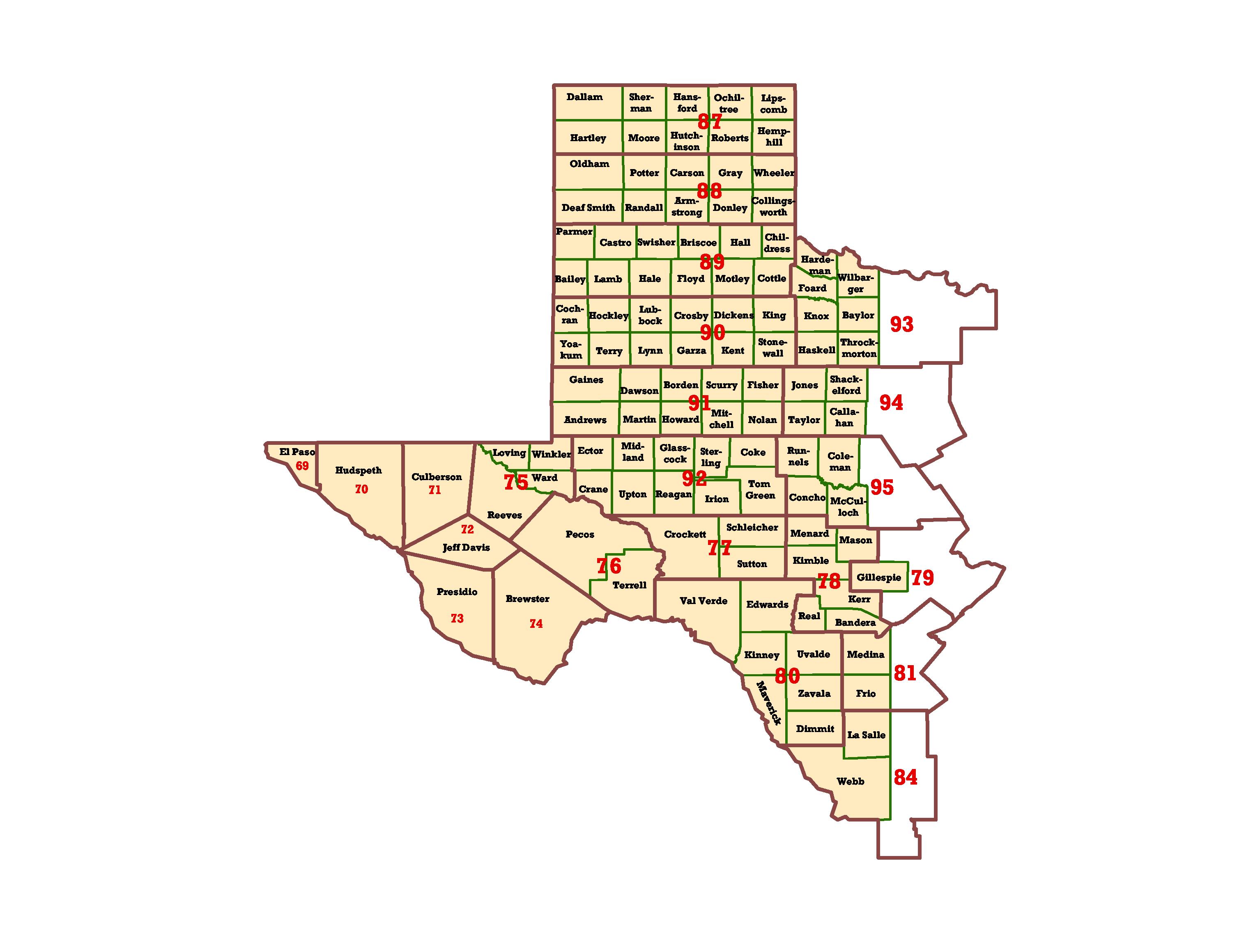
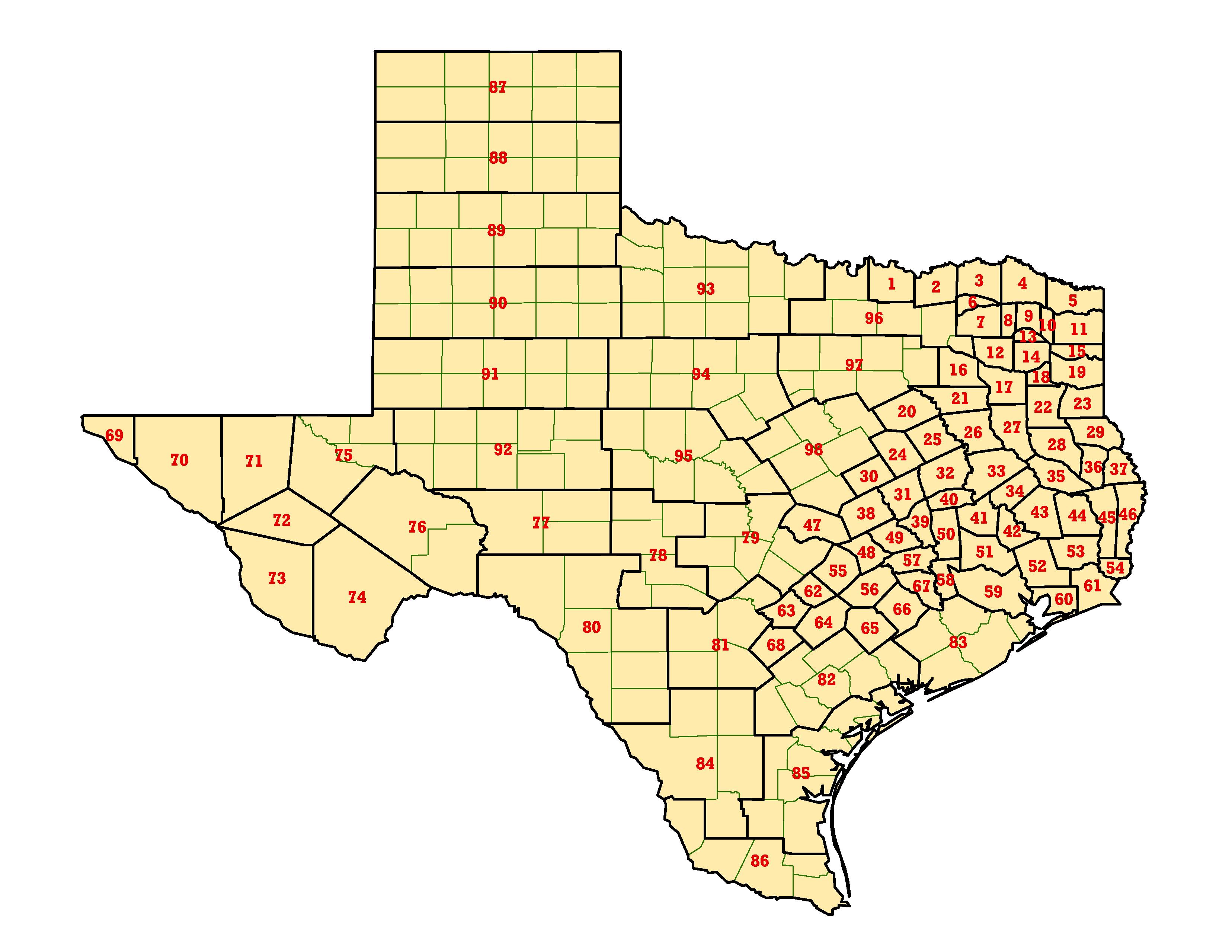
Texas
Northeast Texas
Southeast Texas
West Texas
TX Entire State (no County Names)
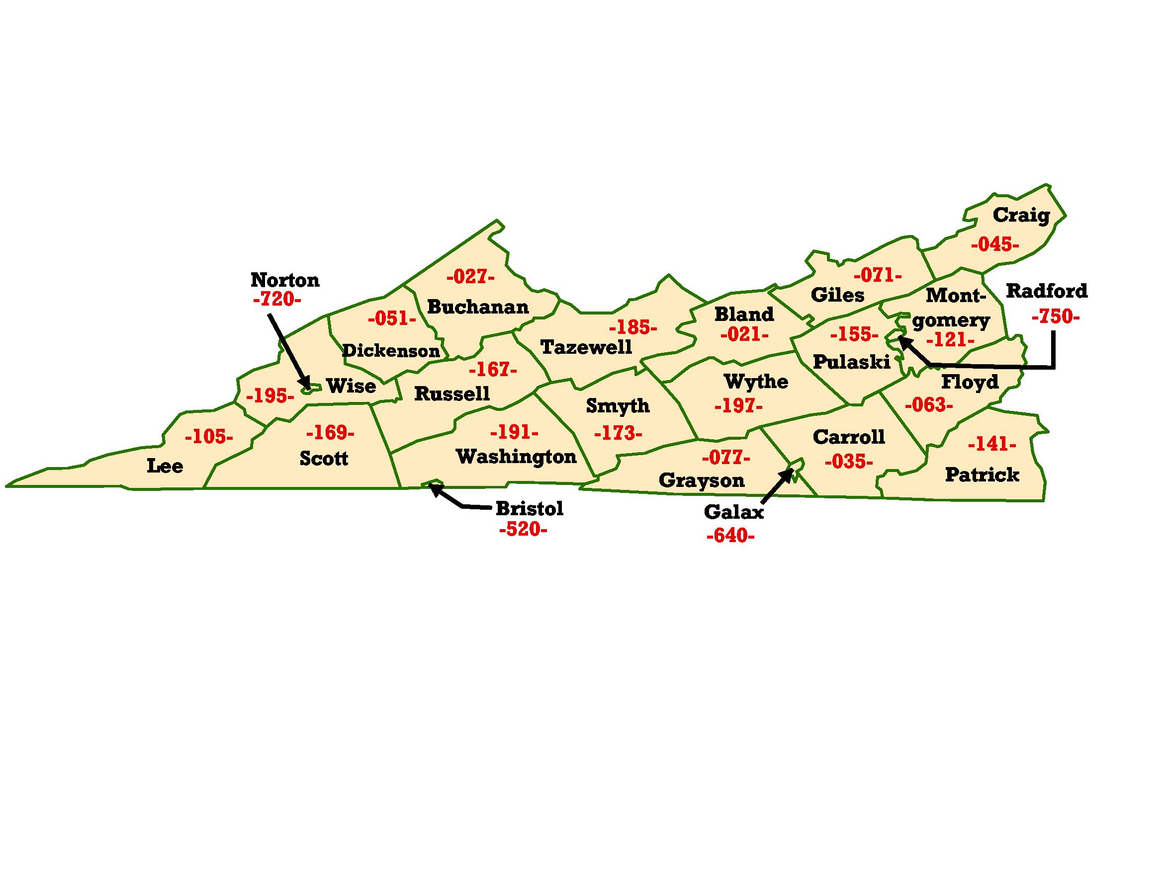
Virginia
Western Virginia
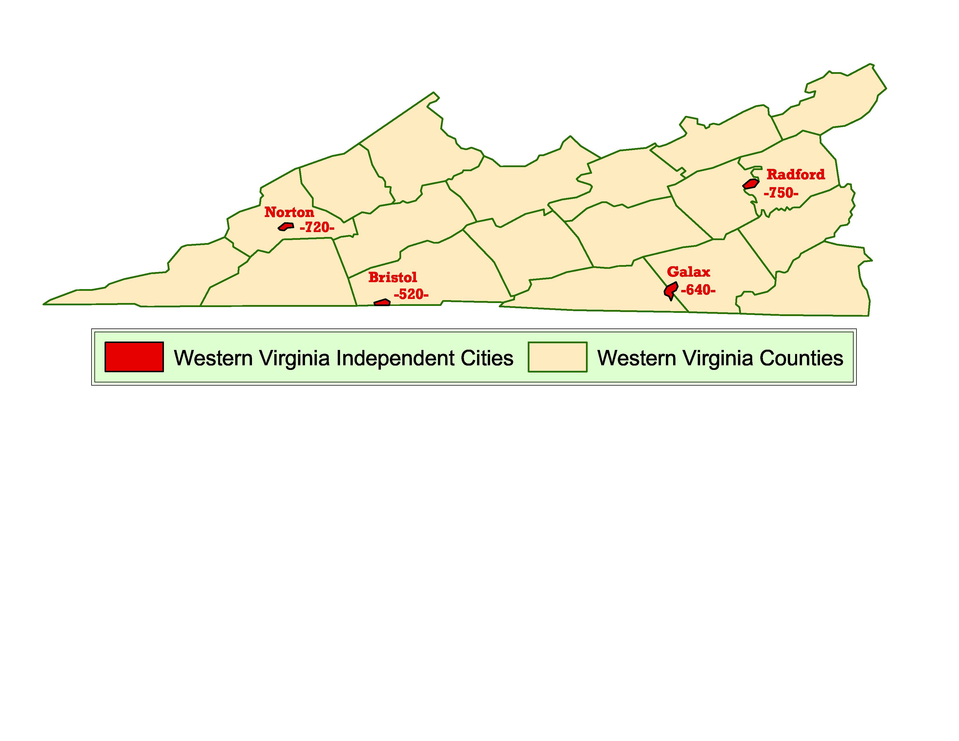
Western
Virginia Independent Cities
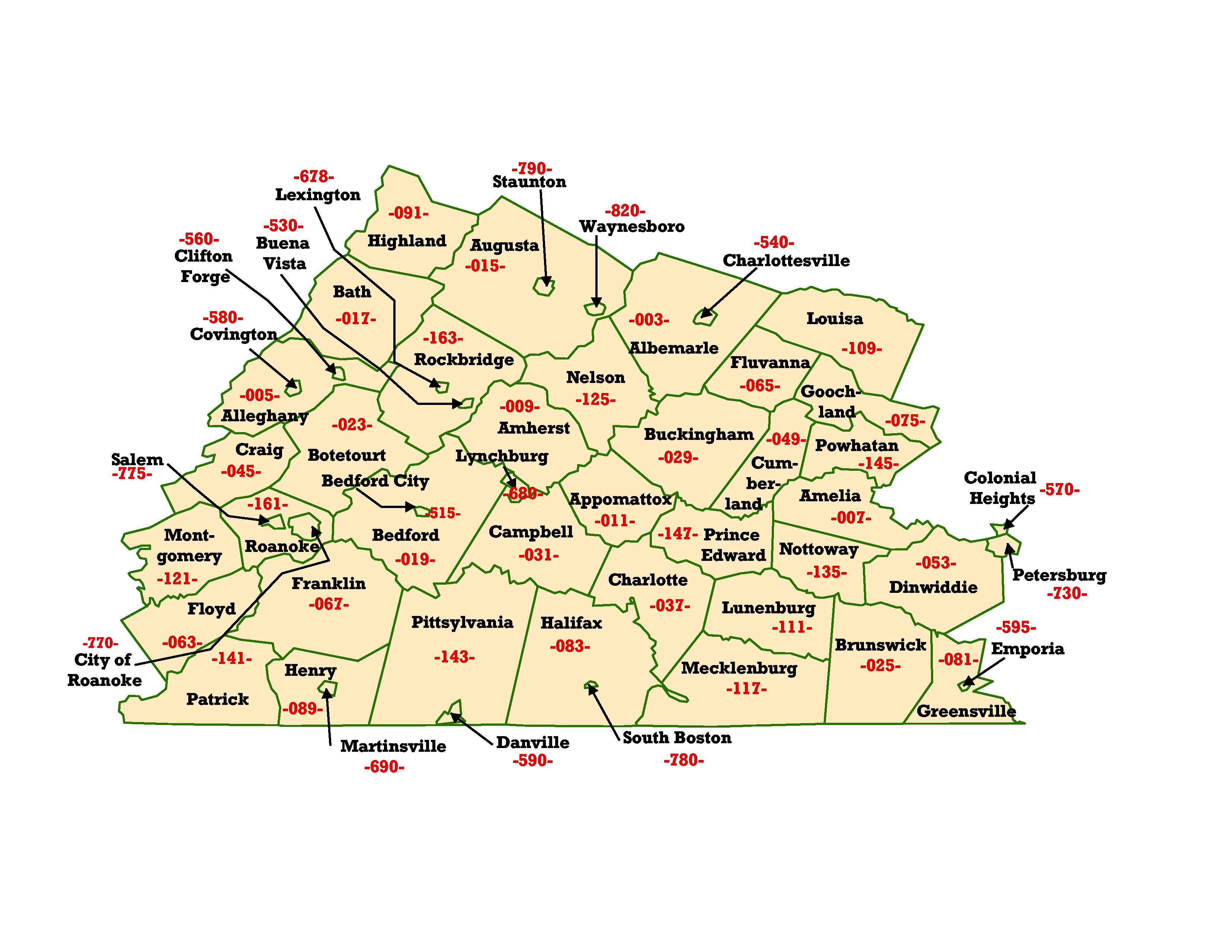
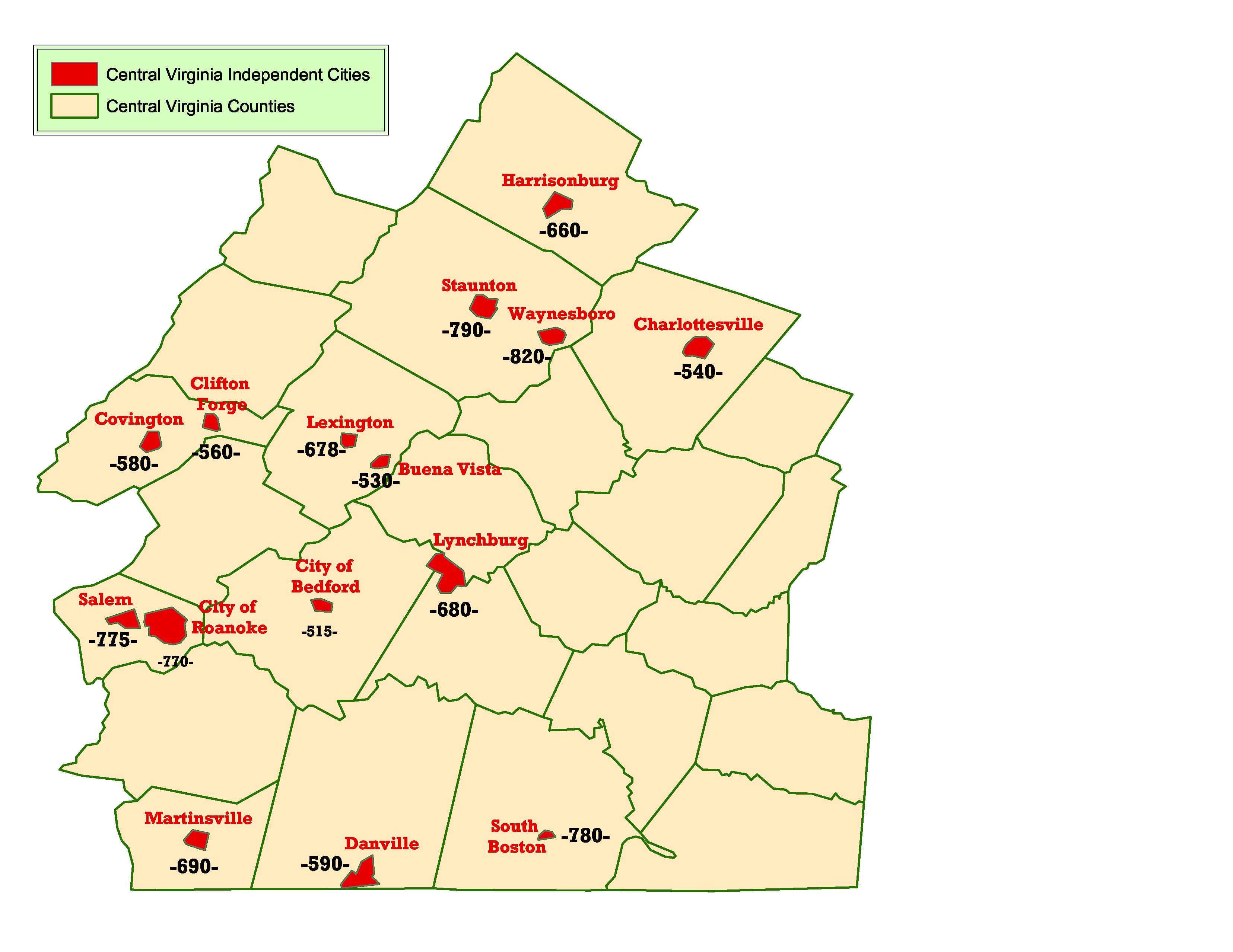
Central Virginia
Central Virginia Independent Cities
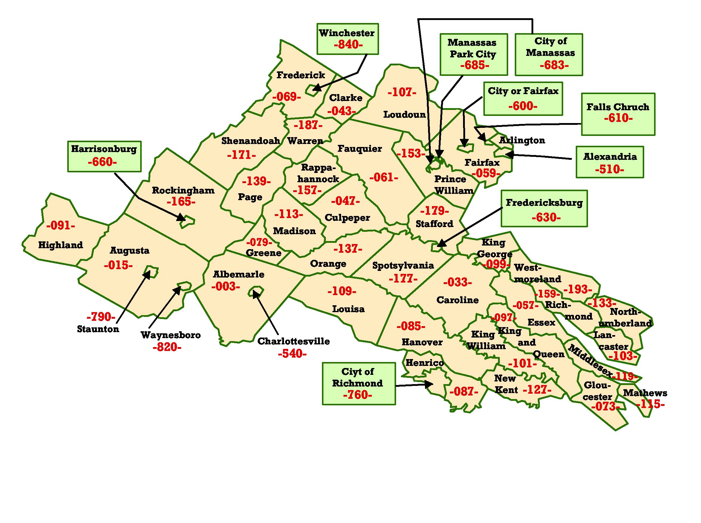
Northern Virginia
Northern
Virginia Independent Cities
Southeastern Virginia
Southeastern
Virginia Independent Cities
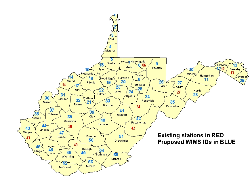
West Virginia
History of
Updates to this page:
Updated
11-24-03 to add Western Tennessee and Northeast
Texas.
Updated 02-03-04 to add the three Oklahoma maps
Updated 02-06-04 to add the eight
Virginia Maps
Updated
02-09-04 to
restore the Central Kentucky, Western Kentucky, and Louisiana Maps that somehow became
corrupted.
Updated 04-27-04 to replace Florida maps with a new set. Old
maps omitted Levy
County. New maps include Levy County.
Updated
05-18-05 to add
Puerto Rico Map and update most of the links to read fs.fed.us/r8/sacc
Updated 05-19-05 to Substitute Western, Central, and
Eastern Puerto Rico Maps.
Updated 10-26-05 for the new SACC web page and to make
available the PowerPoints (both zipped and full), as
well as the national map.
Updated 2-24-12 to add West Virginia
and Maryland to the list.